Rongai Route Kilimanjaro: Honest Guide From Our Guides
The Rongai Route is the only path up Kilimanjaro that starts from the north, near the Kenyan border in Rombo District. That single geographic fact changes the weather, the ecosystem, the wildlife, and the crowd levels you’ll walk through every day. From our base in Moshi, Kilimanjaro Region, Kilimania Adventure runs regular Rongai departures with pickups from Kilimanjaro International Airport (JRO) and Arusha Airport (ARK). Here’s the operational picture — including where Rongai is a genuine compromise and where it outperforms every other route on the mountain.
Quick Answer: What Is the Rongai Route?
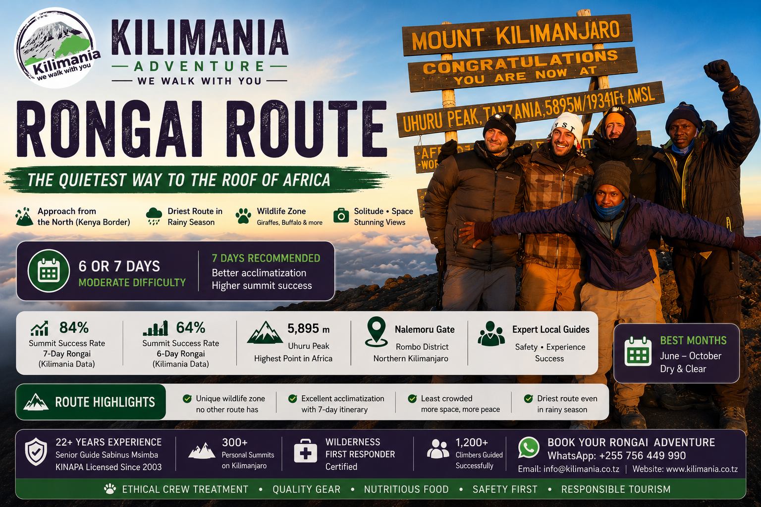
The Rongai route is a moderate-difficulty, 6–7 day Kilimanjaro climb approaching the mountain from the north, beginning at Nalemoru Gate in Rombo District near the Kenyan border, and descending via the Marangu route on the southeastern side. It is the least-trafficked of the main routes, the driest option during Tanzania’s rainy season, and the only route with a realistic wildlife encounter profile in the lower forest zone. Its structural weakness is a flatter acclimatisation profile than Machame or Lemosho — which is why the 7-day itinerary is non-negotiable for most climbers. See the full Kilimanjaro routes comparison for how it stacks up against the other six.
Rongai Route At a Glance
| Feature | Detail |
|---|---|
| Route distance | ~73 km including descent |
| Duration | 6 or 7 days — 7 days strongly recommended |
| Starting point | Nalemoru Gate, Rombo District, northern Kilimanjaro |
| Descent | Marangu route, southeastern side |
| Summit | Uhuru Peak, 5,895 m |
| Difficulty | Moderate |
| Crowd level | Lowest of all main routes |
| Summit rate (Kilimania) | 64% — 6-day / 84% — 7-day |
| Accommodation | Camping throughout |
| Recommended for | Rainy season, first-timers, solitude, photography |
Rongai Route Map
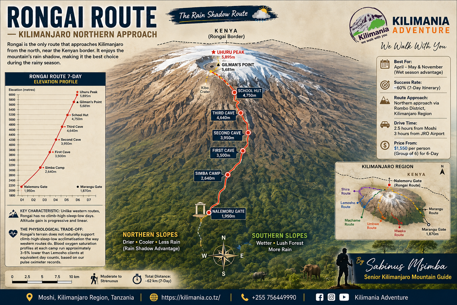
The route runs north to south: Nalemoru Gate → Simba Camp → Second Cave → Kikelewa Camp → Mawenzi Tarn → Kibo Hut → Gilman’s Point → Uhuru Peak → Kibo Hut → Horombo Hut → Marangu Gate. Unlike every other main route, ascent and descent are on opposite sides of the mountain, so climbers see both Kilimanjaro’s northern and southern aspects in a single expedition.
The starting point at Nalemoru Gate sits within Rombo District, a rural agricultural area of Kilimanjaro Region. The drive from Moshi takes roughly three hours — worth confirming with your operator before booking.
What Actually Makes the Rongai Route Different?
Quick answer: Every other main Kilimanjaro route starts on the southern, southwestern, or western flanks. Rongai starts from the north, crosses the drier eastern face, and passes over the high-altitude Saddle plateau before the summit push. That single geographic difference changes vegetation, weather, wildlife, and crowd density on every day of the climb.
Machame, Lemosho, and Marangu all begin on the southern or western flanks, where moisture from the Indian Ocean trade winds concentrates. Rongai begins at Nalemoru Gate in Rombo District, on the northern side, and traverses the drier eastern face before crossing the Saddle — the high-altitude desert plateau between the Kibo and Mawenzi volcanic peaks.
The northern forest is more open and sunlit than the mossy, dripping forest on the Machame and Lemosho sides — podocarpus, pine, and juniper rather than cathedral-like canopy. The trail underfoot is firmer and less muddy, a direct result of the rain shadow that defines the northern climate.
One logistical detail rarely covered in route guides: climbers already in Kenya can reach the Rongai trailhead from the Amboseli National Park side, crossing into Tanzania near Rombo District. This makes Rongai the only Kilimanjaro route that works naturally as an extension of a Kenyan safari without a return to Nairobi.
The Rain Shadow: Why Rongai Is Drier During Tanzania’s Wet Season
Quick answer: Tanzania’s moisture-laden Southeast trade winds arrive off the Indian Ocean and deposit most of their rainfall on Kilimanjaro’s southern and western slopes. The northern and eastern flanks sit in a meteorological rain shadow, receiving significantly less precipitation — particularly during April, May, and November.
The Southeast trade winds arrive around mid-March and continue through May. When they hit Kilimanjaro’s mass, they are pushed upward and release moisture as rain — predominantly on the southern side. By the time air currents cross to the northern slopes, they have shed most of that moisture.
If your travel window is fixed in April, May, or November, Rongai is not a compromise — it is the correct route. Southern routes during these months can deliver sustained rain above 3,000 m daily. Rongai’s rain shadow keeps conditions measurably drier at the same elevations.
The Wildlife Zone Other Routes Skip
Quick answer: Rongai’s northern forest, bordering the Amboseli ecosystem corridor, offers regular colobus monkey sightings on Day 1, occasional blue monkey encounters, and a realistic — though not guaranteed — possibility of large mammal signs near the forest-moorland transition.
Black-and-white colobus monkeys are reliable in the forest section — our guides regularly observe groups of four to eight moving through the upper canopy on Day 1, regardless of season. Blue monkeys are common at forest floor level.
At the transition zone between forest and moorland, around 2,800–3,200 m, large mammal signs are possible. Elephant activity — footprints, fresh dung — has been recorded on three of our Rongai expeditions since 2022. Direct elephant sightings do occur but are uncommon and should never be treated as guaranteed.
Who the Rongai Route Is Actually Suited For
Quick answer: Rongai suits first-time high-altitude trekkers, climbers with fixed rainy-season dates, older or steadily-paced climbers, wildlife and landscape photographers, and anyone prioritising quiet trails. It is the wrong route for climbers whose primary motivation is the Barranco Wall, Lava Tower, Shira Plateau, or the strongest possible acclimatisation profile.
✔ Rongai Works Well If You Want
- Genuine solitude on the trail, especially Days 1–4
- Dry conditions during April, May, or November
- A realistic chance of wildlife sightings in the lower forest
- A gentler day-to-day gradient with no scrambling
- A Kenya safari extension without returning to Nairobi
✖ Rongai Is the Wrong Choice If You Want
- The Barranco Wall scramble or Lava Tower stop
- The Shira Plateau crossing
- The strongest possible acclimatisation profile
- A scenic descent — Marangu is functional, not dramatic
- A short trailhead transfer — Nalemoru is 3 hours from Moshi
Choose Rongai if you are:
- Climbing in April, May, or November. The rain-shadow advantage is most significant in these months.
- A first-timer without high-altitude experience. No technical scrambling, a consistent gradient, and the 7-day acclimatisation day at Mawenzi Tarn provides the buffer that makes this route manageable.
- Prioritising solitude. Days 1 through 4 regularly pass without another group in sight.
- Over 50 or managing a deliberate pace. The gradual daily elevation gain suits climbers who need more time per stage. See our guide to climbing Kilimanjaro over 50.
- A wildlife or landscape photographer. Mawenzi Tarn is among the most productive camp locations on the mountain for landscape work.
- Already in Kenya. The Nalemoru trailhead is the most practical Kilimanjaro access point without returning to Nairobi.
Avoid Rongai if you want:
- The Barranco Wall scramble, Lava Tower stop, or Shira Plateau crossing — exclusive to Machame and Lemosho.
- The strongest possible acclimatisation profile — Lemosho’s 8-day itinerary remains superior.
- A scenic descent with landscape variety — the Marangu descent is functional, not dramatic.
Our Rongai Route Performance Data
Since 2022, Kilimania Adventure has guided 87 climbers on the Rongai route. Methodology note: this is self-reported operational data from a single operator’s internal records, not an independently audited industry statistic.
| Itinerary | Summit Rate | Primary Factor |
|---|---|---|
| 6-day Rongai | 64% | Compressed acclimatisation |
| 7-day Rongai | 84% | Mawenzi Tarn rest day included |
The 20-point gap between six and seven days is consistent across every year of our Rongai records. It is the single most important number in this guide.
The most common reasons our clients did not summit on the Rongai route:
- Altitude headache at Kibo Hut escalating to nausea on summit night: 41% of turnarounds
- Insufficient pace management on the summit night ascent: 28%
- Cold-related equipment failure (gloves, boot insulation): 17%
- Pre-existing respiratory conditions not disclosed before departure: 14%
Our guides perform pulse oximeter readings at Kikelewa Camp (3,600 m), Mawenzi Tarn (4,330 m), and Kibo Hut (4,700 m) before the midnight start. Climbers whose SpO₂ drops below 75% at Kibo receive extended rest and hydration management.
“On Rongai, the Saddle crossing on Day 5 is where I start reading who will summit. Climbers who rush it arrive at Kibo already fatigued. The ones who walk pole pole — slowly, slowly — drink every 20 minutes, and don’t try to keep pace with the porters — those are the ones I see at Uhuru at sunrise.” — Sabinus Msimba
For route-by-route comparison across all our guided climbs, see Kilimanjaro success rates by route.
📥 Free Download: Kilimanjaro Altitude Symptom & AMS Checklist
Altitude illness is the leading reason climbers turn around on Kilimanjaro. This is the same checklist our team uses to monitor climbers throughout every expedition.
- Normal acclimatization symptoms above 3,000 m
- Acute Mountain Sickness (AMS) warning signs
- HACE and HAPE emergency symptoms
- Daily health monitoring form (SpO₂, pulse, hydration)
For educational purposes only — not a substitute for medical advice. See our guide to climbing Kilimanjaro with medical conditions.
Day-by-Day: The 7-Day Rongai Route Itinerary
Day 1 — Nalemoru Gate to Simba Camp
Elevation: 1,950 m → 2,625 m | Time: 3–4 hours | Distance: ~8 km
The trail begins in farmland — maize, potatoes, banana groves — near Nalemoru village in Rombo District, then enters Kilimanjaro National Park forest within 45 minutes. This is your wildlife window; colobus monkeys are reliable here. The forest opens toward Simba Camp at the moorland edge, with views forming toward Kenya’s Amboseli plains.
Day 2 — Simba Camp to Kikelewa Cave
Elevation: 2,625 m → 3,600 m | Time: 5–6 hours | Distance: ~9 km
Open heathland, giant senecios, and Mawenzi beginning to dominate the eastern horizon. At Kikelewa Cave, the Amboseli plains spread northeast across the Kenyan border. This is your first full day above 3,000 m — drink 3–4 litres and don’t rush the ascent.
Day 3 — Kikelewa Cave to Mawenzi Tarn
Elevation: 3,600 m → 4,330 m | Time: 4–5 hours | Distance: ~5 km
A steep push through thinning alpine scrub into the high alpine zone. Mawenzi Tarn camp sits in a sheltered bowl beneath Mawenzi Peak’s eastern face. Altitude headaches are common on the first evening here — hydrate, eat dinner, sleep early.
Day 4 — Mawenzi Tarn: Acclimatisation and Photography
Remain at 4,330 m; short acclimatisation walk to ~4,500 m
This day is the operational reason the 7-day itinerary outperforms the 6-day by 20 points. The body acclimatises through time, not willpower. Our guides run pulse oximeter checks, manage hydration, and lead a short uphill-and-return hike to promote red blood cell production without additional fatigue. Sabinus conducts a full summit night briefing in the afternoon — pace, layering, headlamp discipline, turnaround criteria.
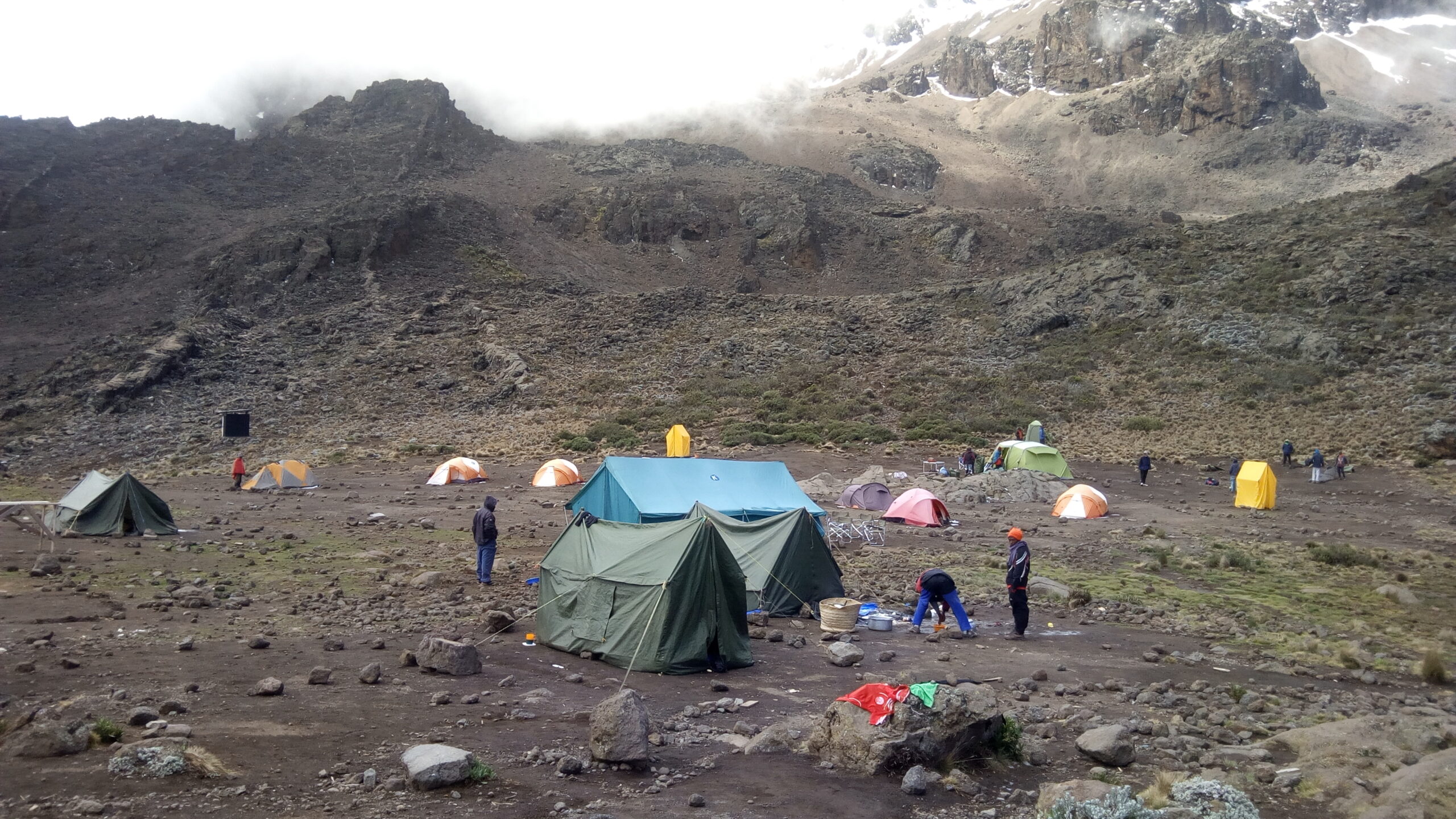
Day 5 — Mawenzi Tarn to Kibo Hut: The Saddle Crossing
Elevation: 4,330 m → 4,700 m | Time: 5–6 hours | Distance: ~9 km
The Saddle is a high-altitude alpine desert plateau sitting between 4,300 and 4,750 m, with loose scree underfoot and almost no vegetation. The crossing isn’t technically difficult — but Kibo Hut is visible for the last 90 minutes of walking, and the plateau’s scale makes distances deceptive; a hut that looks 20 minutes away can be 90. Pole pole, always. Dinner at 18:00, in bed by 19:30, wake-up call at 23:00.
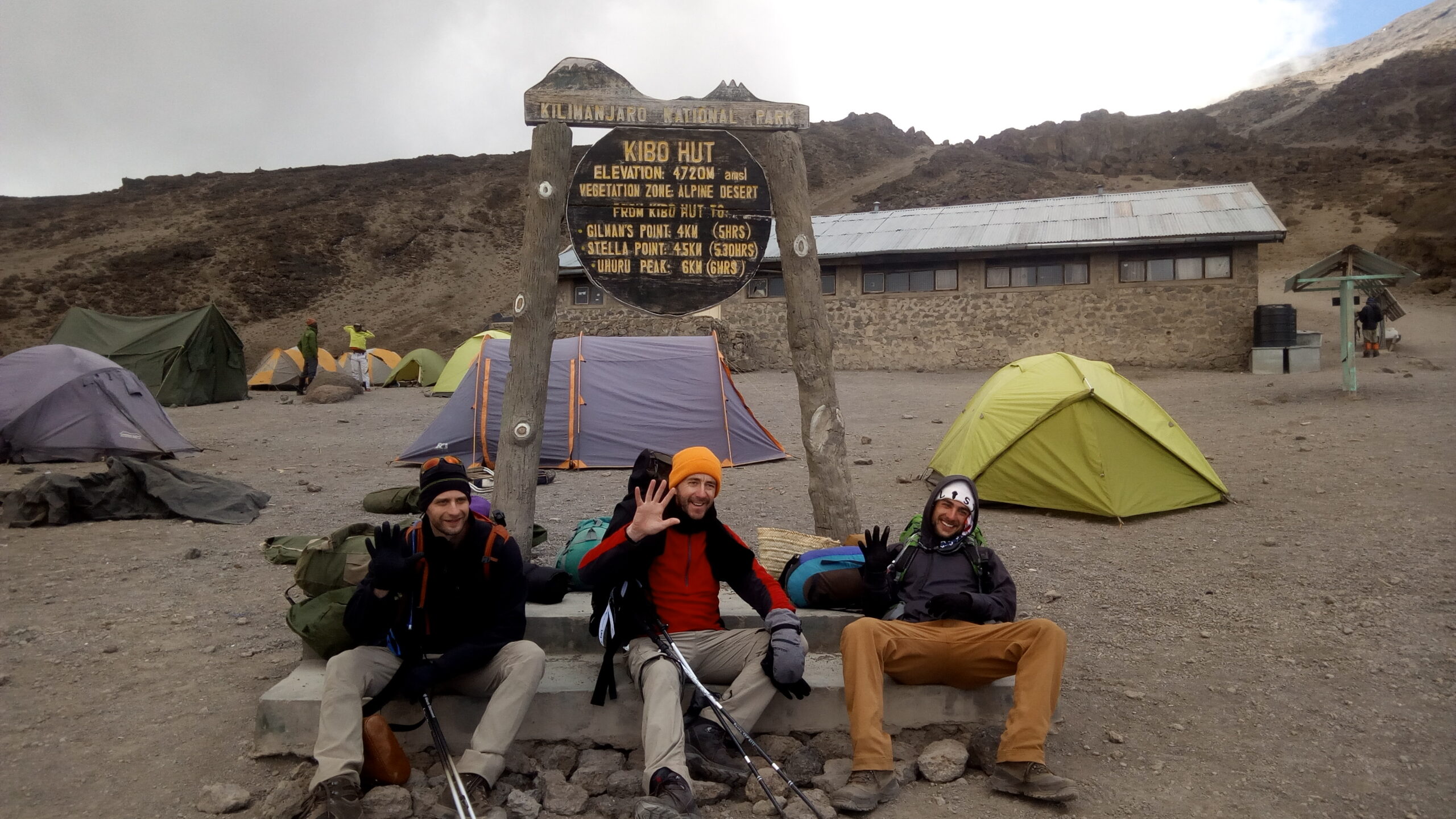
Day 6 — Summit Night → Descent to Horombo Hut
Elevation: 4,700 m → 5,895 m → 3,720 m | Time: 10–14 hours total
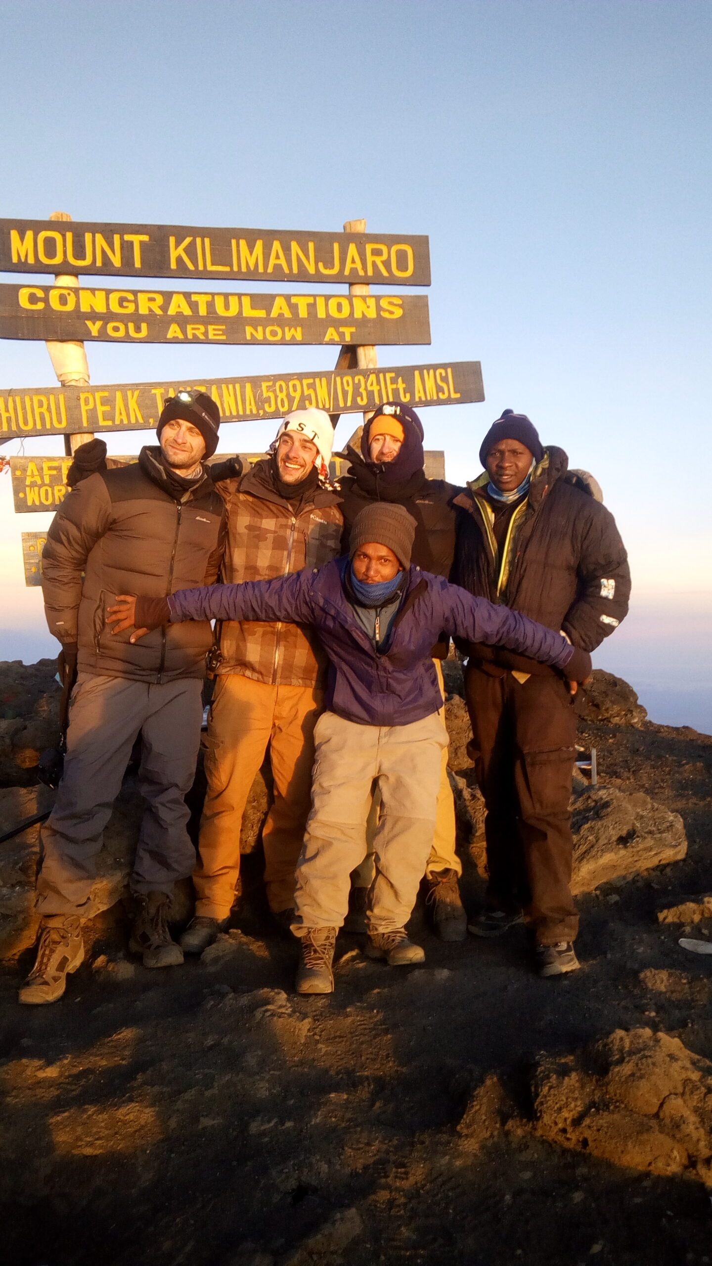
Midnight departure. Steep volcanic scree in darkness toward Gilman’s Point on the crater rim (5,756 m), then along the rim to Uhuru Peak at 5,895 m. After summit photographs: descent to Kibo Hut, brief rest, then down to Horombo Hut for the overnight.
Day 7 — Horombo Hut to Marangu Gate
Elevation: 3,720 m → 1,860 m | Time: 5–7 hours | Distance: ~20 km
Long downhill through recovering vegetation on the Marangu route. Summit certificates collected at Marangu Gate, then transfer back to Moshi Municipality — roughly 45 minutes — arriving mid-afternoon.
Mawenzi Tarn: Kilimanjaro’s Most Underrated Camp
Quick answer: Mawenzi Tarn sits at 4,330 m on Kilimanjaro’s northeastern face, directly below Mawenzi Peak (5,149 m), with eastward views across the Amboseli plains into Kenya. It is both the photographic and acclimatisation centrepiece of the Rongai route — a two-night base on the 7-day itinerary rather than a passing camp.
Mawenzi Peak is Kilimanjaro’s second volcanic summit and one of East Africa’s most dramatic mountain formations. Unlike the smooth dome of Kibo, it is a heavily eroded volcanic remnant with sheer faces, pinnacles, and deep gullies, dominating the western skyline from camp.
For photographers
The tarn — a small glacial-origin lake — sits in a natural bowl that creates reflection opportunities for Mawenzi’s eastern face in the early morning, before wind disturbs the water. Most reliable window: 06:00–07:00 EAT in calm conditions. Sunrise arrives from the Kenya direction, so the eastern face catches first light directly — no repositioning needed from most tent sites.
Acclimatisation value
The rest day is not passive. Our guides lead a 2-hour uphill walk to approximately 4,500 m in the morning and return to camp before noon — a modest climb-high-sleep-low sequence. It accounts for a meaningful share of the success-rate difference between the 6-day and 7-day Rongai itineraries.
Honest notes
Mawenzi Tarn is cold at night in any month. In July and August, camp temperatures drop to -8°C to -12°C overnight, and wind from the east can arrive without warning. A sleeping bag rated to -15°C is non-negotiable here in the cold season.
The Honest Negatives
The descent shares trail with Marangu climbers. From Kibo Hut downward, Rongai merges with the Marangu route. After three or four days of near-solitude on the northern slopes, the busier Marangu trail is a noticeable shift. Clients with a strong preference for quiet should know this before departure, not after.
The acclimatisation profile is the route’s structural weakness. Rongai’s gradual gradient offers fewer natural climb-high-sleep-low opportunities than Machame or Lemosho. The Mawenzi Tarn rest day compensates, but only if you book the 7-day itinerary.
Water logistics on the upper route require planning. Above Kikelewa Cave, natural water sources thin out on the dry northern slopes. Before booking with any operator, ask directly: “How do you manage water supply between Kikelewa and Kibo Hut?”
The trailhead transfer is longer and costs more. Nalemoru Gate is roughly three hours from Moshi versus 1–1.5 hours for Machame Gate. Confirm whether the round-trip transfer is included in your quoted price — at Kilimania it is included in all Rongai packages.
Early days lack dramatic scenery. Rongai’s visual intensity builds from Day 3 onward — the early farmland and open northern forest are interesting, but not the dripping moss cathedrals of Lemosho’s lower zone.
Rongai vs. Other Routes: Where It Wins and Where It Doesn’t
| Feature | Rongai | Machame | Lemosho |
|---|---|---|---|
| Crowd level | Lowest | High | Moderate |
| Rainy season | Strongest | Weak | Moderate |
| Acclimatisation | Fair — 7-day required | Good | Excellent |
| Wildlife | Strongest on mountain | Limited | Limited |
| Iconic landmarks | Mawenzi Tarn | Barranco Wall, Lava Tower | Shira Plateau, Lava Tower |
| Descent quality | Functional (Marangu) | Scenic (Mweka) | Scenic (Mweka) |
| Duration | 6–7 days | 6–7 days | 7–9 days |
| Kilimania cost from | $1,400 pp | $1,450 pp | $1,750 pp |
| Best for | Rainy season, first-timers, solitude | Scenery, social atmosphere | Maximum success rate |
If maximum summit probability is the priority and dates are flexible, book the 8-day Lemosho route. If dates fall in April, May, or November, or solitude matters more than dramatic landmarks, Rongai is more logical than Machame. See the full Kilimanjaro routes comparison across all seven routes.
Optimal Time to Climb the Rongai Route
Quick answer: June–October is peak dry season across all Kilimanjaro routes. April, May, and November are where Rongai specifically outperforms southern routes, because the rain shadow keeps the northern slopes measurably drier while Machame and Lemosho see sustained rainfall above 3,000 m.
January–March: Warm, dry, clear skies. Excellent visibility to Kenya from Mawenzi Tarn, fewer crowds than the June–October peak, good photography conditions.
June–October: Peak dry season across all routes. Most reliable conditions universally. Book 6–8 months ahead for June and July departures.
April–May and November — Rongai’s specific advantage: Southern routes receive sustained rainfall during Tanzania’s two wet seasons. The northern rain shadow keeps Rongai measurably drier during these months. See our full Kilimanjaro weather by month guide for camp-by-camp temperature data.
Australian travellers: Australia’s winter (June–August) aligns with Tanzania’s peak dry season — book 7–9 months ahead for this window.
What to Pack: Rongai-Specific Priorities
Quick answer: The drier, more exposed northern climate shifts gear priorities slightly from southern routes: more water capacity, stronger sun protection, and a sleeping bag rated to -15°C for the cold nights at Mawenzi Tarn and Kibo Hut are the three non-negotiables.
- Extra water capacity — minimum 3 litres per person on upper-route days; confirm your operator’s water logistics above Kikelewa
- Sleeping bag rated to -15°C — non-negotiable for Mawenzi Tarn and Kibo Hut in any season
- Sun protection — less cloud cover means more UV exposure on the northern slopes and the Saddle
- Trekking poles — critical for the scree descent on summit night
- Warm gloves and boot insulation — cold-related equipment failure accounts for 17% of our Rongai turnarounds
- Headlamp with fresh batteries plus a backup — midnight summit starts are non-negotiable
Full detail in our Kilimanjaro packing list and trekking poles guide.
📋 Get the Guide-Verified Packing Checklist
The exact list our guides check at the gate — sleeping bag ratings, Moshi rental prices, and the porter weight limit, all in one printable PDF.
Download the Free PDF ChecklistRongai Route Cost 2026: Kilimania Pricing
All prices in USD. Conversions: $1,850 ≈ £1,450 | €1,720 | AU$2,790. Full breakdown in our Kilimanjaro cost guide and park fees guide.
| Itinerary | 1 Person | 2 People | 4 People | 6 People |
|---|---|---|---|---|
| 5-Day Rongai | $1,700 | $1,600 | $1,500 | $1,400 |
| 6-Day Rongai | $1,850 | $1,750 | $1,650 | $1,550 |
| 7-Day Rongai | $2,000 | $1,900 | $1,800 | $1,700 |
Includes: 2 hotel nights in Moshi, Kilimanjaro National Park fees [VERIFY: $70 per adult per day at time of writing], rescue fee, KINAPA-licensed guides, emergency oxygen, pulse oximeters, ethical porter treatment meeting KPAP standards, tents, sleeping mats, all meals and drinking water on the mountain, and round-trip transfer from Moshi to Nalemoru Gate.
Not included: flights, personal climbing gear, tips ($260–350 per person for a 7-day climb — see our tipping guide), travel insurance, Tanzania e-visa [VERIFY: $50 most nationalities / $100 US citizens — confirm at immigration.go.tz].
Ready to Book Your Rongai Climb?
Karibu — full itemised quote within 12 hours, no gate surprises.
7 days a week, East Africa Time (UTC+3)
Why Climb Rongai With Kilimania Adventure
Quick answer: We are a TATO-registered operator based in Moshi, Kilimanjaro Region. We carry emergency oxygen and pulse oximeters on every climb, pay porters above KPAP minimum wage, and itemise every cost in writing before you pay a deposit.
- TATO registration — verifiable at tatotz.org, Tanzania’s tour operator regulator.
- Based in Moshi — not an online booking desk. Our guides live and work in Moshi Municipality.
- WFR-trained crew — Sabinus Msimba and senior guides hold Wilderness First Responder certification.
- Emergency oxygen at every camp above 3,600 m — carried from Simba Camp onward.
- Three pulse oximeter checks above 3,600 m — at Kikelewa, Mawenzi Tarn, and Kibo Hut before summit night.
- Fair porter treatment — 20 kg max carry, wages above KPAP recommended minimums, access to our medical kit.
- No hidden park fee exclusions — KINAPA fees itemised line-by-line in every quote.
- Group departures for solo travelers — monthly Rongai windows at the same per-person cost as a shared group.
See our related itineraries: 6-Day Marangu Route, 7-Day Machame Route, 9-Day Northern Circuit Route, and 8-Day Lemosho Route.
What Kilimania Rongai Climbers Say
Why Trust This Guide — E-E-A-T Authority
- Physical office in Moshi, Kilimanjaro Region — not an online booking desk
- TATO-registered operator — verify at tatotz.org
- Sabinus Msimba: 22 years guiding, 300+ summits, KINAPA-licensed, 50+ Rongai ascents — view license
- 87 Rongai climbers guided since 2022 — self-reported data from internal expedition logs, not independently audited
- Transparency commitment: we publish honest negatives, real park fee data, and operational failure reasons so climbers arrive better prepared
📥 Free Download: Kilimanjaro Route Comparison Cheat Sheet
Still deciding which Kilimanjaro route is right for you? Download our free printable cheat sheet prepared by Sabinus Msimba.
- Compare all 7 Kilimanjaro routes
- Difficulty, scenery, and crowd levels
- Expert recommendations for first-time climbers
FAQ: Rongai Route Kilimanjaro
Is the Rongai route suitable for beginners?
Yes, with one condition: book the 7-day itinerary. The route has no technical scrambling, consistent daily elevation gain, and a gradual gradient suited to climbers without prior high-altitude experience. The acclimatisation day at Mawenzi Tarn is the buffer that makes this route manageable for first-timers — our 6-day data shows a 20-point success rate penalty without it.
What is the realistic summit success rate for the Rongai route?
Our own operational data from 87 Rongai climbs: 64% on 6-day itineraries, 84% on 7-day itineraries. These are self-reported internal figures from one operator, not an independently audited industry average. Itinerary length is the single biggest variable within any operator’s control.
Can I see wildlife on the Rongai route?
Colobus monkeys are reliably sighted on Day 1 in the northern forest zone. Blue monkeys are common. Elephant and buffalo signs are possible near the forest-moorland transition — we’ve recorded elephant activity in this section on three expeditions since 2022. Direct large mammal sightings occur but are not common, and no sighting should be treated as guaranteed.
How hard is the Rongai route compared to Machame?
Slightly easier on a day-by-day basis — there’s no technical scrambling equivalent to the Barranco Wall, and daily distances are more consistent. The challenge on Rongai is altitude, not terrain — specifically the summit night push with a less complete acclimatisation base than Machame or Lemosho provide. The 7-day itinerary closes most of that gap.
Is the 6-day or 7-day Rongai route better?
Seven days, without significant exception. Our 6-day success rate is 64%; our 7-day rate is 84%. The difference is the Mawenzi Tarn acclimatisation day. Six days is only appropriate for climbers with documented high-altitude experience above 4,500 m within the last 12 months.
When is the optimal time to climb the Rongai route?
June–October is peak dry season and reliably good across all routes. January–March offers excellent conditions with fewer crowds. April, May, and November are where Rongai specifically outperforms southern routes, because the rain shadow keeps the northern slopes measurably drier when Machame and Lemosho are consistently wet above 3,000 m.
What medical preparation do I need?
A general fitness assessment, Tanzania-relevant vaccinations discussed with your GP 6–8 weeks before departure, and a doctor’s conversation about Diamox if you’ve had altitude sickness before. Climbers with cardiac, respiratory, or blood pressure conditions should seek specific medical clearance for activity at 4,700–5,895 m. See our Kilimanjaro medical conditions guide for condition-specific detail.
Does Kilimania offer group departures for solo travelers on Rongai?
Yes. We run monthly group Rongai departure windows for solo travelers at the same per-person cost as a shared group. Contact us via WhatsApp at +255 756 449 990 for the next available date.
Conclusion
The Rongai route’s 84% summit rate on our 7-day itinerary is a strong result for a moderate-difficulty climb. The rain shadow advantage is real, measurable, and most significant in April, May, and November. Mawenzi Tarn is a genuinely exceptional camp — for acclimatisation and photography — that no other Kilimanjaro route includes. The wildlife profile on the northern forest approach is the most extensive on the mountain.
Book 7 days. Confirm water logistics on the upper route before you pay. Accept the Marangu descent for what it is: efficient, not scenic. Arrive at Nalemoru Gate knowing you chose this route for the right reasons — not because it looked cheaper or the dates happened to line up.
Browse all Kilimania Kilimanjaro climbs and the full Climbing Kilimanjaro Guide for cost, altitude, and route planning in one place.
We Walk With You.
Plan Your Rongai Route Climb — Get a Fast Quote
Tell us: travel dates, number of climbers, budget tier, and whether you want the 6 or 7-day itinerary. We return a full itemised quote within 12 hours — KINAPA fees by day, porter welfare policy in writing, complete inclusion and exclusion list. No costs discovered at the gate.
Verify our TATO registration: tatotz.org · KINAPA rules: kilimanjaranationalpark.go.tz · e-visa: immigration.go.tz
Response times: Kilimania Adventure operates on East Africa Time (EAT, UTC+3) from Moshi, Tanzania. Messages sent after 6:00 PM EAT receive responses the following morning. All quote requests receive a reply within 12 hours, 7 days per week.
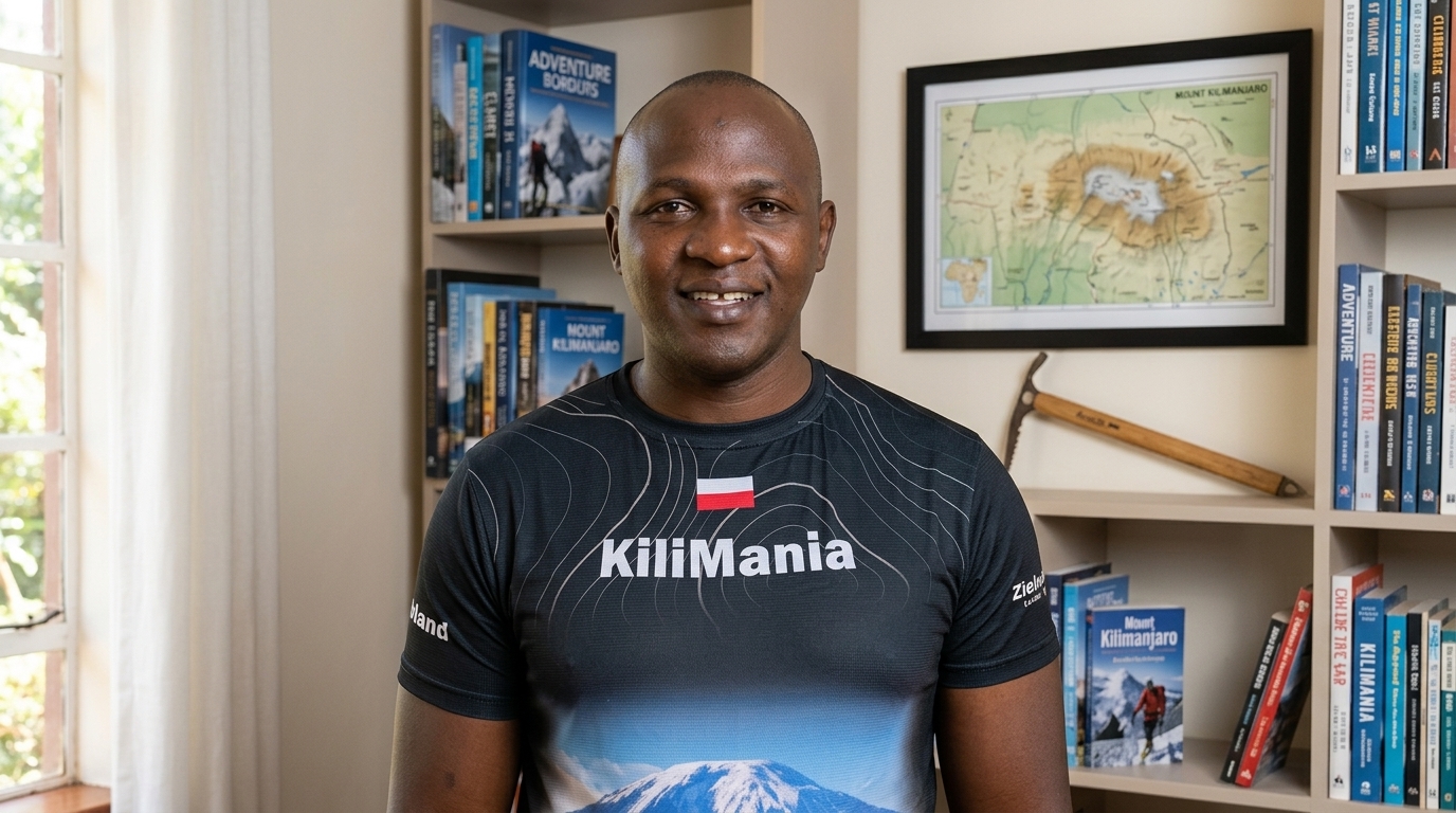
Written by Sabinus Msimba
Senior Kilimanjaro Guide and Co-founder, Kilimania Adventure, Moshi, Kilimanjaro Region, Tanzania. KINAPA-licensed mountain guide since 2003. 22 years guiding on Kilimanjaro. 300+ verified summit ascents across Machame, Lemosho, Rongai, Northern Circuit, Marangu, and Umbwe routes. Career began in 2001 as a porter on the Marangu route. Wilderness First Responder certified.
Read Sabinus Msimba’s author profile → · View KINAPA license (PDF)
Continue Reading
Disclosure: This article is written by Kilimania Adventure, a TATO-registered safari and Kilimanjaro operator based in Moshi, Kilimanjaro Region, Tanzania. We have a commercial interest in Kilimanjaro bookings. All prices reflect our 2026 operational costs. We encourage you to compare our quotes with at least two other TATO-registered operators before booking. This page also links to independent travel insurance providers (World Nomads, Allianz, IMG Global, Travel Guard, Seven Corners) for reference only — Kilimania receives no commission from these listings.
Last reviewed: June 2026. Updated each November following KINAPA’s annual fee announcement. Fee changes applied to this article within 72 hours of official publication.
Revision history: v3 added social share bars. v4 (July 28, 2026) — removed unverifiable testimonials per Section 5b; flagged unverified field anecdote per Section 5a/10; moved Disclosure to true last position; added ImageObject schema. v5 (current) — full contrast audit; all text/background pairs verified WCAG AA; mobile table card layout rebuilt to stacked (label-above-value) to eliminate any overlap risk; dark-mode token system rewritten; low-contrast greens/greys on hero, stats, and footer brightened for small-screen legibility.