
Shira Plateau Day Hike: Kilimanjaro’s High Plateau in One Day
Data sources cited in this article: Londorossi Gate park signage, KINAPA route information, and Kilimania Adventure’s own operational records from guiding this day trip.
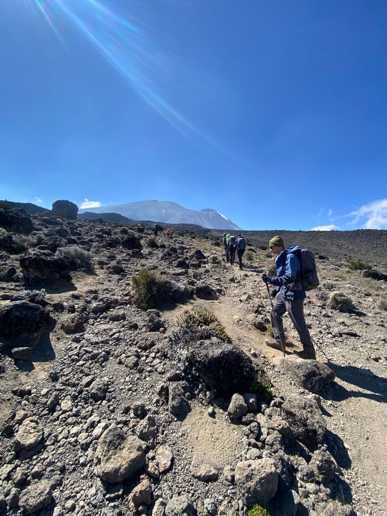
The Shira Plateau day hike reaches 3,500–3,800 m on the western side of Mount Kilimanjaro, more than 800 m above the Mandara Hut endpoint of the Marangu day hike. You get there by 4×4 vehicle from Londorossi Gate, then walk across an exposed, high-altitude moorland where the terrain is easy but the altitude is not. Mild altitude sickness symptoms are possible, since the trip climbs from Moshi’s roughly 900 m to well over 3,400 m in a single day.
Shira is a collapsed volcanic caldera on Kilimanjaro’s western flank at 3,500–3,800 m, reached by 4×4 through Londorossi Gate (about two hours from Moshi). A guide is mandatory. Because guests sleep near 900 m the night before, mild altitude symptoms are possible. It is not recommended for children or for anyone with a history of severe altitude sickness.
Shira Plateau day hike — key facts
| From Moshi | Approximately 2 hours by 4×4 to Londorossi Gate; 4×4 required |
| Plateau altitude | 3,500–3,800 m |
| Shira Peak | 3,962 m |
| Shira Cathedral | Approximately 3,720 m |
| Terrain | Collapsed caldera; open, weather-exposed moorland |
| Difficulty | Moderate underfoot — altitude is the real demand |
| Walking start | Morum Barrier, the edge of the plateau (approximately 3,400 m) — the 4×4 drop-off point |
| Typical endpoint | Shira Cathedral (Cathedral Point), approximately 3,720 m — the most common turnaround for day hikers |
| Walking distance (round trip) | 8–12 km is most common; some days extend to 17–20 km depending on the exact route and how far past the plateau edge the group goes |
| Walking time | 4–7 hours, plus lunch and rest stops |
| Guide | Mandatory |
| Children | Not recommended — altitude and exposure |
| Limited mobility | Not suitable |
| Wildlife | Rare — buffalo and eland tracks; elephants occasionally |
| What’s included | Private transport, driver-guide, park/route fees, packed lunch and drinking water |
| Pickup | From Moshi hotels; pickup from Arusha is also available — confirm drive time with the team when booking |
| Best season | Clearest mornings in June–October and January–February — see the seasonal guide below |
| Price | From $190 pp for a group of five — see the trip page |
Guests sleep at Moshi level (approximately 900 m) but spend several hours at 3,400–3,800 m on the plateau. Mild altitude sickness symptoms are possible. Inform your guide immediately if you feel unwell. Do not attempt this trip if you have experienced severe altitude sickness before.
Altitude guidance reviewed against KINAPA park information, September 2026.
Table of contents
- What Shira is, and how it differs from Marangu
- Getting there: the 4×4 drive to Londorossi Gate
- What the plateau looks like
- Altitude on the Shira Plateau
- Who this trip is for
- Who should choose something else
- Shira Plateau vs Marangu day hike
- Sabinus’s note from the trail
- Frequently asked questions
- Related day trips
What Shira is, and why it’s different from the Marangu day hike
Shira is the collapsed remains of Kilimanjaro’s oldest volcanic centre — a broad, high moorland at 3,500–3,800 m on the mountain’s western side, inside Kilimanjaro National Park, a UNESCO World Heritage Site. There are no trees up here and little shelter from wind or cloud.
This is not the same trip as the Kilimanjaro day hike most people mean by that phrase. That trip usually refers to the Marangu day hike to Mandara Hut, which keeps you in sheltered montane forest up to about 2,700 m. Shira puts you on an exposed plateau more than 800 m higher, reached by vehicle rather than on foot from the park gate. The two trips are run separately, with different guides and different risk profiles — never treat one as a substitute for the other.
Getting there: the 4×4 drive to Londorossi Gate
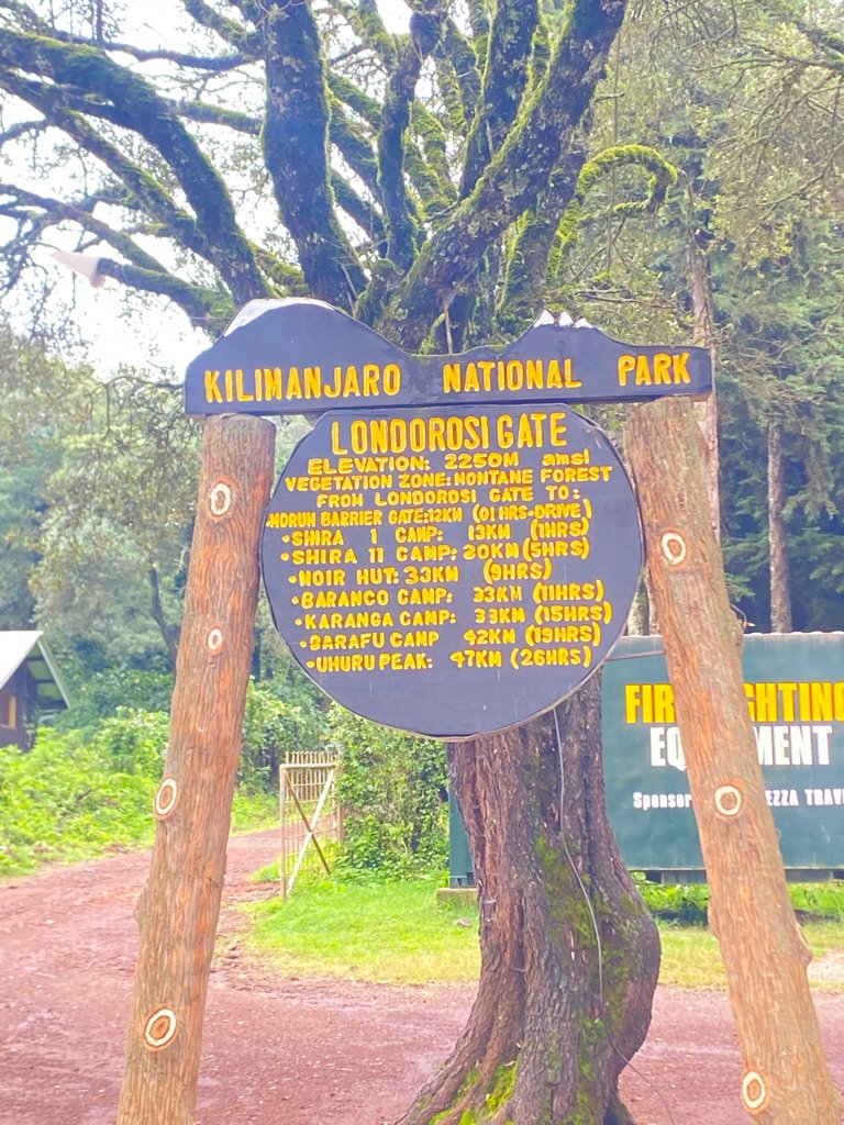
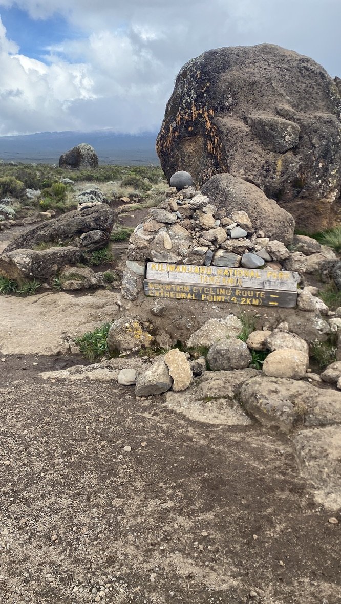
Londorossi Gate is the entry point for the western side of Kilimanjaro. From Moshi it is approximately two hours by road, and a 4×4 is required for the route. The park sign at the gate lists elevation and distances to the camps along the routes that start here, so this is the same entrance multi-day Lemosho climbers use.
After registering at the gate, the vehicle continues by 4×4 track to Morum Barrier, at the edge of the plateau (approximately 3,400 m) — this is where the walking begins. From there, most day hikers walk to Shira Cathedral (Cathedral Point, approximately 3,720 m) and back, a round trip most commonly in the 8–12 km range, though some days extend to 17–20 km depending on the exact route and how far past the plateau edge the group goes. Walking time typically runs 4–7 hours including lunch and rest stops. The point that matters for planning is that the vehicle does most of the climbing — multi-day climbers walk through the forest and heath zones over a day or two before reaching this same plateau, while a day trip skips that transition entirely.
What the plateau looks like
The vegetation: giant groundsels and lobelias
This is moorland, not forest. The plants that stand out are giant groundsels (Dendrosenecio kilimanjari), which grow on thick trunks with a rosette of leaves at the crown, and giant lobelias (Lobelia deckenii) with tall flowering spikes. Both are specialists of high East African mountains. If you have only seen Kilimanjaro’s rainforest belt, the change in scale and colour is obvious within the first few minutes on the plateau.
The weather at 3,500 m
The plateau is weather-exposed. Clear mornings are common in the dry seasons, and cloud tends to build later in the day, which is why an early start is standard practice. Dress for conditions much colder and windier than Moshi: layers, a waterproof shell, a hat and gloves. Guests are often surprised by how different the temperature feels the moment they step out of the vehicle. For month-by-month conditions across all of Kilimania’s day trips, see the best day trips from Moshi guide.
What you can see from the plateau
On a clear morning, the western face of Kibo rises above the moorland, and park markers point towards Cathedral Point — Shira Cathedral, at approximately 3,720 m, is the reference viewpoint on this side. Some groups with time and good acclimatisation extend further to Shira Cone (3,962 m, also called Shira Peak), the plateau’s highest point, though this is not the standard day-hike turnaround. In cloud, expect a much shorter view, and no guide can promise a clear summit.
| Point | Elevation |
|---|---|
| Moshi (start) | Approximately 900 m |
| Londorossi Gate | Approximately 2,250 m |
| Morum Barrier (walk starts here) | Approximately 3,400 m |
| Shira Cathedral (Cathedral Point) | Approximately 3,720 m |
| Shira Cone / Shira Peak (extension only) | 3,962 m |
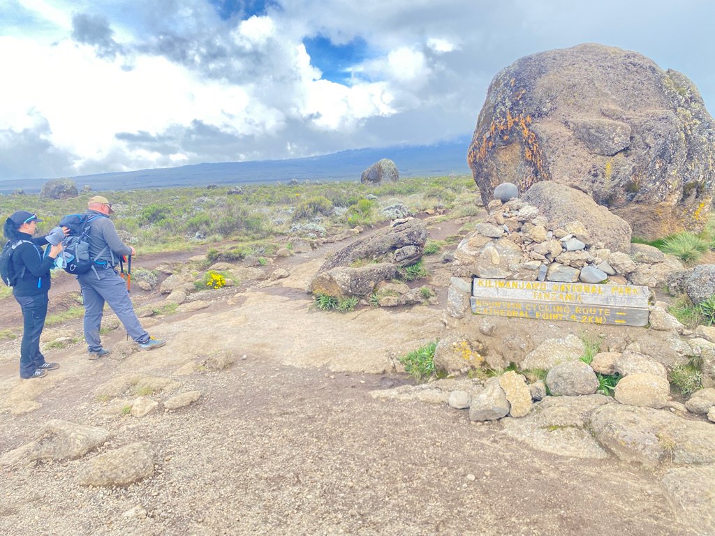
One thing surprises many guests: the plateau is shared ground. Multi-day Lemosho Route climbers cross the same terrain on their way up, so on some days you will pass groups who have already been walking for several days. Wildlife is possible but rare — buffalo and eland tracks are occasionally seen, and elephants more rarely still — and a sighting should never be counted on.
Ready to plan the day?
Private day trip — price per person. The more people travelling together, the lower the price per person.
| Group Size | Price Per Person |
|---|---|
| 1 person | $285 |
| 2 people | $245 |
| 3 people | $220 |
| 4 people | $205 |
| 5 people | $190 |
For groups larger than five, contact Kilimania Adventure for a group quotation. Full itinerary and booking are on the trip page.
View trip details & bookCheck availability for your group
Send your details and Kilimania Adventure will confirm the exact price for your group size, availability, and pickup time.
Altitude on the Shira Plateau — what you need to know
Guests sleep at Moshi level (approximately 900 m) but spend several hours at 3,400–3,800 m on the plateau. Mild altitude sickness symptoms are possible. Inform your guide immediately if you feel unwell. Do not attempt this trip if you have experienced severe altitude sickness before.
Altitude guidance reviewed against KINAPA park information, September 2026.
Acclimatisation needs time. A multi-day climb is built around it; this day trip goes from roughly 900 m to over 3,400 m in a single morning, by vehicle, with no walking days in between to adjust. That is why the terrain is easy but the day itself is not.
Common effects at this height include a headache, faster breathing at an ordinary walking pace, fatigue, and reduced appetite or mild nausea. Most cases are mild, which is exactly why guests are watched closely and the pace is kept slow.
- Tell your guide as soon as you feel unwell — do not hide symptoms to keep the group moving.
- Drink steadily and eat something, even if your appetite is low.
- If symptoms worsen, descending is the standard response, and your guide makes that call.
- If you have a heart or lung condition, or you are unsure, speak to your doctor before booking.
- Do not attempt this trip if you have previously experienced severe altitude sickness (HACE or HAPE) — these are medical emergencies at altitude, not something to push through.
Travel insurance that covers high-altitude activity and emergency evacuation is worth checking before you travel — confirm it applies at 3,800 m. World Nomads is one provider that covers this altitude; compare it against your own policy. General guidance from KINAPA is a reasonable starting point for park rules.
Who this trip is for
This trip works for
- Fit adults comfortable walking on uneven ground for several hours
- Travellers who have been at 3,000 m or higher before with no serious reaction
- Future Kilimanjaro climbers who want to feel this altitude before a multi-day route
- Photographers who want the western face of Kibo without a multi-day commitment
- Anyone interested in high-altitude moorland plants
This trip is not for
- Children — altitude and exposure make it unsuitable
- Anyone with a history of severe altitude sickness
- Anyone with limited mobility
- Anyone expecting a gentle forest stroll
- Anyone counting on seeing wildlife
Who should choose something else
Altitude reminder: guests sleep at approximately 900 m but spend several hours at 3,400–3,800 m. Do not attempt this trip if you have experienced severe altitude sickness before.
- Families with children: the Marangu Waterfalls & Cultural day trip stays at much lower elevation.
- Anyone wary of altitude: the Marangu day hike to Mandara Hut stays in forest at about 2,700 m.
- First-time hikers: start lower and build up — Shira is a poor place to find out how you react to altitude.
- Anyone who wants a relaxed, low-key day: the drive is long and the plateau is exposed, so a gentler trip is a better fit.
Shira Plateau vs Marangu day hike — quick comparison
Both trips enter Kilimanjaro National Park, but at very different heights and from different sides. Altitude is the deciding factor for most travellers weighing these two against each other.
| Feature | Shira Plateau | Marangu day hike |
|---|---|---|
| Altitude | 3,500–3,800 m | Approximately 2,700 m (Mandara Hut) |
| Terrain | High-altitude moorland, exposed plateau | Sheltered montane forest trail |
| Access | 4×4 to starting point | On foot from Marangu Gate |
| Vegetation | Giant groundsels, lobelias | Forest, moss-covered trees |
| Altitude risk | Mild AMS possible | Negligible |
| Children | Not recommended | Generally suitable |
| Main challenge | Altitude | Walking distance |
For more on the lower-altitude alternative, see the Marangu day hike to Mandara Hut guide.
Sabinus’s note from the trail
The detail people rarely expect is who else is on the plateau. Lemosho Route climbers cross the same ground on their way up, and they have usually been walking for days by the time we meet them — their bodies have had time to adjust, and a day-trip guest arriving by vehicle has had none. The scenery looks the same for both groups; how it feels does not. That’s why I set the pace by whoever in the group is struggling, not by the fastest walker.
— Sabinus Msimba, Senior Kilimanjaro Guide, 22+ years guiding on Kilimanjaro
Frequently asked questions
How high does the Shira Plateau day hike go?
The Shira Plateau day hike reaches 3,500–3,800 m, with Shira Peak at 3,962 m and Shira Cathedral at approximately 3,720 m. That is over 800 m higher than the Marangu day hike’s Mandara Hut endpoint (about 2,700 m). You reach it by 4×4 vehicle from Londorossi Gate rather than on foot from the park entrance.
Is the Shira Plateau day hike difficult?
The walking itself is moderate — the plateau is relatively flat and the trail is not technical. The real difficulty is the altitude: shortness of breath at 3,500 m or higher is common even for fit, experienced walkers, simply because the vehicle ascent gives the body no time to adjust before the walking starts.
Can you get altitude sickness on the Shira Plateau day trip?
Yes, mild altitude sickness symptoms are possible. Guests sleep at Moshi level (approximately 900 m) but spend several hours at 3,400–3,800 m on the same day. Tell your guide immediately if you feel unwell, and do not attempt this trip if you have experienced severe altitude sickness before.
What is the difference between Shira Plateau and the Kilimanjaro day hike?
“Kilimanjaro day hike” usually refers to the Marangu route to Mandara Hut, a sheltered forest trail at about 2,700 m. The Shira Plateau day hike reaches 3,500–3,800 m on an exposed volcanic plateau with different vegetation and a real altitude consideration. They are separate trips with different risk profiles, not two names for the same experience.
Is the Shira Plateau day trip suitable for children?
No, it is not recommended for children because of the altitude and exposure. The Marangu day hike to Mandara Hut is a lower-altitude alternative that is generally a better fit for families.
Do you need to acclimatise before the Shira Plateau day trip?
No prior acclimatisation is required, but resting for a day in Moshi after your flight before attempting the trip is sensible. This day trip is itself sometimes used by climbers as an altitude-exposure day ahead of a multi-day Kilimanjaro route.
What should I bring on the Shira Plateau day hike?
Warm layers, a waterproof shell, a hat and gloves, sun protection, sturdy walking boots, a daypack and at least 2 litres of water. Conditions on the plateau are colder and windier than Moshi, and weather can change through the day. See the Shira Plateau day trip page for the full packing guidance.
Can you see Kibo from the Shira Plateau?
On clear mornings, yes — the western face of Kibo is visible above the moorland, often best before midday cloud builds. Cloud cover is common by the afternoon, so no clear view can ever be guaranteed.
How far do you walk on the Shira Plateau day hike?
The vehicle drops you at Morum Barrier, on the edge of the plateau at approximately 3,400 m, and most groups walk to Shira Cathedral (Cathedral Point, approximately 3,720 m) and back — a round trip most commonly in the 8–12 km range, taking 4–7 hours including lunch and rest stops. Some days extend to 17–20 km depending on the exact route and how far past the plateau edge the group goes.
Still deciding between Shira and Marangu?
Message the team on WhatsApp: +255 756 449 990 with your group and fitness level — we’ll tell you honestly which trip fits.
See the Marangu day hikeRelated day trips
The Shira Plateau day hike is a 3,500–3,800 m day with an easy path and a demanding altitude. Choose it if you’re fit and have been high before; choose the Marangu day hike if you’re not sure. We Walk With You.
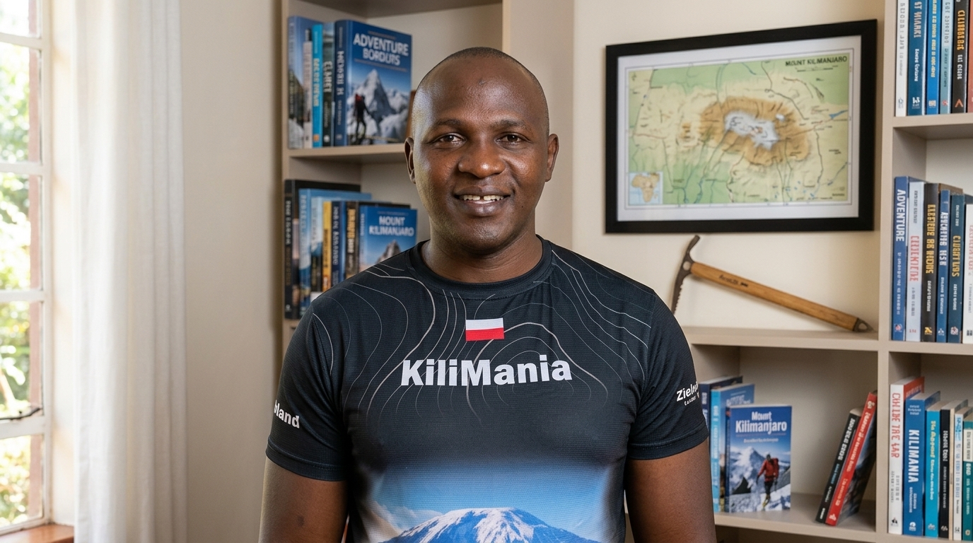
22+ years guiding on Mount Kilimanjaro, 300+ personal Uhuru Peak summits, and KINAPA-licensed since 2003.
Full biography · KINAPA licence (PDF) · Read verified reviews on TripAdvisor
Disclosure: This guide is written by Sabinus Msimba of Kilimania Adventure, which operates the Shira Plateau day trip described here, based on operational experience guiding this route. The price shown is per person in USD for a private group of five and is correct as of September 2026; see the trip page for the full group-size pricing. Altitude and route figures are drawn from park signage, KINAPA route data, and Kilimania’s own operational experience on this trip. Walking distance varies by exact route and turnaround point (8–12 km typical, occasionally 17–20 km), so treat it as a range rather than a fixed figure. This is general information, not medical advice.