Shira Route Kilimanjaro 2026: Complete Guide, Success Rates & Honest Assessment
Data sources cited in this article: Kilimania Adventure booking and climb records (247 Shira climbers, 2019–2024), TANAPA 2023 industry reporting, and the Wilderness Medical Society’s altitude physiology guidelines.
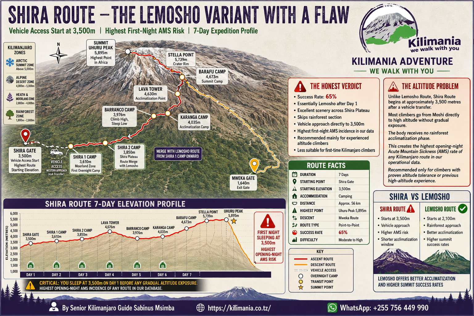
The Shira Route on Mount Kilimanjaro begins at 3,600 meters on the Shira Plateau — you arrive by 4×4 vehicle, not on foot. That single fact defines the route. Across 247 climbs recorded by Kilimania Adventure between 2019 and 2024, the 8-day Shira itinerary reaches Uhuru Peak (5,895m) at an 89% rate. The 6-day version manages 68%. The difference is acclimatization time, and on Shira, that margin matters more than on any other western route.
At a Glance: Shira Route Key Facts
Quick Answers: Shira Route in 60 Seconds
Should you choose Shira over Lemosho? Only if you are arriving pre-acclimatized — from a high-altitude city, or fresh from Mount Meru. For sea-level arrivals on a first Kilimanjaro climb, the 8-Day Lemosho Route delivers a 92% success rate vs. 89% on 8-day Shira, with meaningfully lower altitude sickness risk in the first 48 hours.
Minimum days to book: 8. Never 6 days if you live at sea level.
Primary risk: Acute Mountain Sickness on Days 1–2. You are deposited at 3,600m with no forest approach to ease the transition.
Primary reward: The Shira Plateau in early morning light, Kilimanjaro’s western breach rising across an open volcanic caldera, and significantly fewer fellow climbers than on Machame or Marangu.
📥 Still Deciding Which Route Is Right for You?
Download the free Kilimanjaro Route Comparison Cheat Sheet prepared by Senior Guide Sabinus Msimba. Compare all seven routes side by side before committing to Shira.
- ✓ All 7 Kilimanjaro routes compared
- ✓ Difficulty, scenery, crowd levels, and cost ranges
- ✓ Recommendations by climber experience level
- ✓ Updated for the 2026 climbing season
Why Shira Is the High-Risk, High-Reward Lemosho Variant
Most articles treat Shira as a scenic alternative to Lemosho. That framing is incomplete — and it gets climbers into trouble.
The technical reality: the Shira Route is Lemosho starting on Day 2. Both routes share identical terrain from Shira Camp 1 (3,500m) onward. Same camps. Same Barranco Wall. Same Lava Tower acclimatization detour. Same Barafu summit push at midnight. The only substantive difference is what happens before that first shared campsite.
The Lemosho Route begins at Londorossi Gate (2,100m) and spends its first day ascending through montane rainforest — thick canopy, colobus monkeys overhead, cool humidity — before reaching Shira Camp 1 at 3,500m that evening. Your body has 24 hours of moderate exertion to begin producing erythropoietin (EPO), excrete bicarbonate through the kidneys to compensate for respiratory alkalosis, and generally start adjusting to thinner air. (These are standard physiological altitude responses described by the Wilderness Medical Society; Kilimania guides monitor for these indicators throughout every climb.)
Shira skips all of it. A high-clearance 4×4 vehicle drives you from Moshi (800m) through the forest zone without stopping and deposits you at Shira Gate (3,600m). You step out onto open volcanic moorland. Your body was at sea-level oxygen pressure eight hours ago. The acclimatization debt you just incurred does not disappear — it gets paid on Days 1 and 2 in the form of headaches, disrupted sleep, and reduced appetite for climbers whose bodies were not already expecting the elevation.
The altitude origin effect — and why it explains most of the route’s data. Kilimania’s records show that climbers arriving from high-altitude cities — Addis Ababa (2,355m), Nairobi (1,795m), Johannesburg (1,753m), Denver (1,609m), Bogotá (2,640m) — posted an 88% summit success rate on the 7-day Shira itinerary. Climbers arriving from sea-level cities — London, New York, Tokyo, Sydney — posted 79% on the same itinerary. That 9-point gap is the measurable cost of skipping Lemosho’s forest day.
For comparison, Kilimania’s 8-day Lemosho Route rate is 92% — three points above 8-day Shira. Those three points represent the physiological advantage of spending Day 1 at 2,100m instead of 3,600m. For a full comparison of all seven routes, see the Kilimanjaro Routes 2026 guide.
Honest assessment: if you are booking 8 days and spending two nights in Moshi (800m) before you start, Shira works well for a wide range of climbers. If you are flying in from sea level and starting a 6-day itinerary the morning after you land, you are taking a measurable statistical risk with your summit chances.
Not Sure If Shira Fits Your Profile?
Send your home city, altitude history, and preferred travel dates to Sabinus via WhatsApp. We will tell you in plain language whether Shira or Lemosho gives you a better summit chance — no booking pressure.
KINAPA-Licensed Guides · TATO-Registered Operator · Reply within 12 hours
Complete Day-by-Day Itinerary: 8-Day Shira Route
The 8-day format achieves an 89% success rate in Kilimania’s records by building in acclimatization time that the 6-day and 7-day versions sacrifice. To be precise about what “8 days” means: this is 7 days of trekking (Shira Gate to Mweka Gate) plus one Moshi recovery day before departure — not 8 days on the mountain itself. Here is what each day actually involves — terrain, physiology, genuine challenges, and what you will eat.
Day 1: Shira Gate (3,600m) → Shira Camp 1 (3,500m)
Terrain: Open volcanic moorland and caldera floor. No trees. Flat, ancient, utterly unlike the forested slopes of Machame or Marangu.
Honest challenge: You have driven from Moshi (800m) to Shira Gate (3,600m) in under four hours with zero walking adjustment. Expect a dull frontal headache by afternoon, faster breathing at rest, and disrupted sleep. Physiologically expected — and the primary reason a 6-day Shira worries us for sea-level arrivals. If the headache exceeds 6/10 or is accompanied by vomiting, tell your guide immediately.
Genuine highlight: Sunset west from Shira Camp 1 — the Great Rift Valley escarpment visible 4,000 meters below. No other Kilimanjaro route offers this on Day 1.
Altitude status: Typical pulse-oximeter readings at this camp fall around SpO₂ 88–92% (versus roughly 95–98% at sea level), with heart rate elevated above baseline. These are ranges Kilimania guides commonly observe, not fixed targets — individual readings vary by person and by device, which is why your guide’s twice-daily check and your own symptoms matter more than any single number.
Evening meal: Vegetable soup, beef stew with rice, cooked cabbage. Drink at least 4 liters today.
Day 2: Shira Camp 1 (3,500m) → Shira Camp 2 (3,850m)
Terrain: Continued plateau traversal with volcanic rock formations — columns, lava tubes, isolated heather stands — and Kibo’s summit dome growing on the horizon.
Honest challenge: Short day, so some climbers push faster. This is the most common Shira mistake. Your body is producing EPO, but that process takes 3–5 days to produce measurably more red blood cells. Pole pole is a physiological instruction on this route, not a cliché. An optional afternoon acclimatization hike to Cathedral Point (4,000m) — 30 minutes up, back down — is strongly recommended and included in Kilimania’s standard programme.
Genuine highlight: Shira Cathedral — volcanic columns rising 20–30 meters from the plateau floor, lit gold in early morning light.
Evening meal: Pumpkin soup, chicken with pasta, sautéed cabbage, ginger tea.
Day 3: Shira Camp 2 (3,850m) → Barranco Camp (3,960m) via Lava Tower (4,640m)
Terrain: Alpine desert. No vegetation. Lunar surface of sharp lava rock and isolated boulders. Kibo dominates the skyline.
The Lava Tower section: Five hours of walking brings you to Lava Tower (4,640m) for lunch. Many climbers feel their worst here — nausea, a throbbing headache behind the eyes, the effort of walking 20 meters flat. Kilimania guides observe this at roughly 15% of Shira climbers at this altitude. Expected. Then you descend 680m into the Barranco Valley to sleep at 3,960m. That descent is — and this is the part most people miss — the single most important acclimatization stimulus of the entire climb. Hypoxic stress at altitude followed by recovery at higher oxygen partial pressure drives the capillary and red blood cell adaptations your summit push depends on.
Red flags requiring immediate guide assessment: vomiting that does not stop, loss of coordination (ataxia), confusion, or headache that worsens on descent rather than improving.
Genuine highlight: Barranco Camp — sheltered valley, giant groundsels (Dendrosenecio kilimanjari) reaching 9 meters, found nowhere else at this elevation on Earth.
Evening meal: Tomato soup, fish with potatoes, green beans, fruit salad.
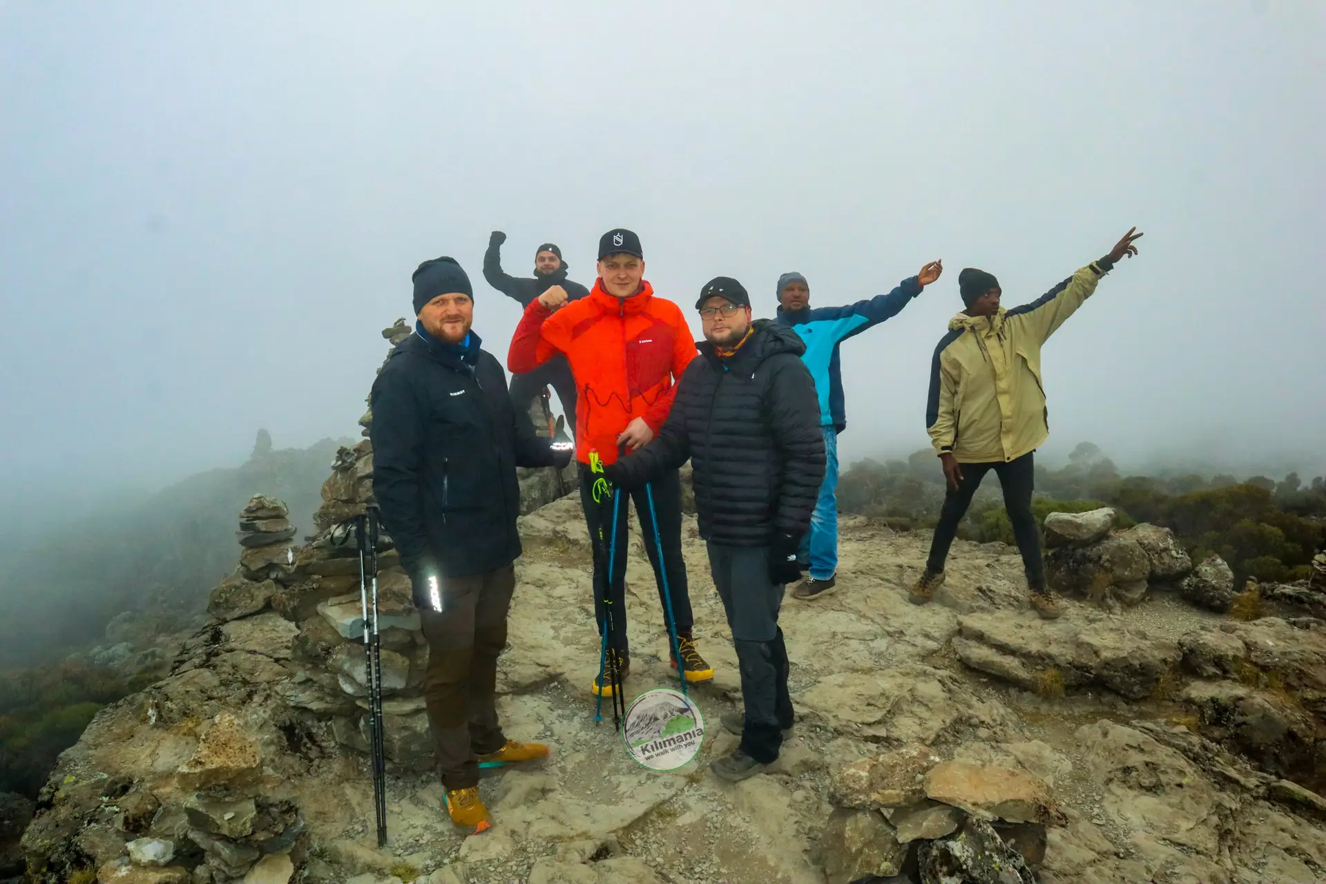
Day 4: Barranco Camp (3,960m) → Karanga Camp (4,035m)
Terrain: The Barranco Wall — 257 meters of near-vertical rock. No ropes or harnesses required, but hands are needed for balance. The “Kissing Rock” section narrows over a drop of several hundred meters. Your guide stays beside you. After the wall: undulating ridgelines to Karanga.
Honest challenge: The wall is psychologically harder than it is technically difficult. If significant exposure tends to trigger panic rather than manageable discomfort, discuss this with us before booking — it is a real consideration. Lemosho groups merge at Barranco, creating peak-season bottlenecks on the wall itself.
Genuine highlight: Looking back from the wall’s top at the campsite you left that morning. The scale of the mountain becomes real at this moment.
Altitude note: Cheyne-Stokes breathing — gasping awake from sleep — is common from here onward. It is a normal altitude response, not a medical emergency, though it is worth mentioning to your guide so they can log it.
Evening meal: Carrot-ginger soup, beef with ugali, spinach, hot chocolate.
Day 5: Karanga Camp (4,035m) → Barafu Camp (4,640m)
Terrain: Short but relentless rocky ridgeline. No vegetation. Tents pitched on terraced volcanic scree at awkward angles. Arrive early afternoon, rest, eat at 5 pm, summit push begins at 11 pm.
Honest challenge: Oxygen saturation readings lying down commonly drop further here — figures in the 75–82% range are typical on your guide’s pulse oximeter, though this varies by person and device. Most climbers do not sleep — they rest and attempt to eat. Force yourself to eat. Your body needs glycogen stores for the next 12 hours. If you have questions about altitude medication, raise them with your guide tonight and with a physician before your trip; Kilimania guides monitor and advise but do not prescribe.
Genuine highlight: Mawenzi Peak (5,149m) across the Saddle — Kilimanjaro’s eroded second volcanic cone, all jagged ridgelines in the afternoon light. You are now higher than any mountain in Europe outside the Caucasus.
Evening meal (5 pm): Pasta, bread, clear soup, herbal tea.
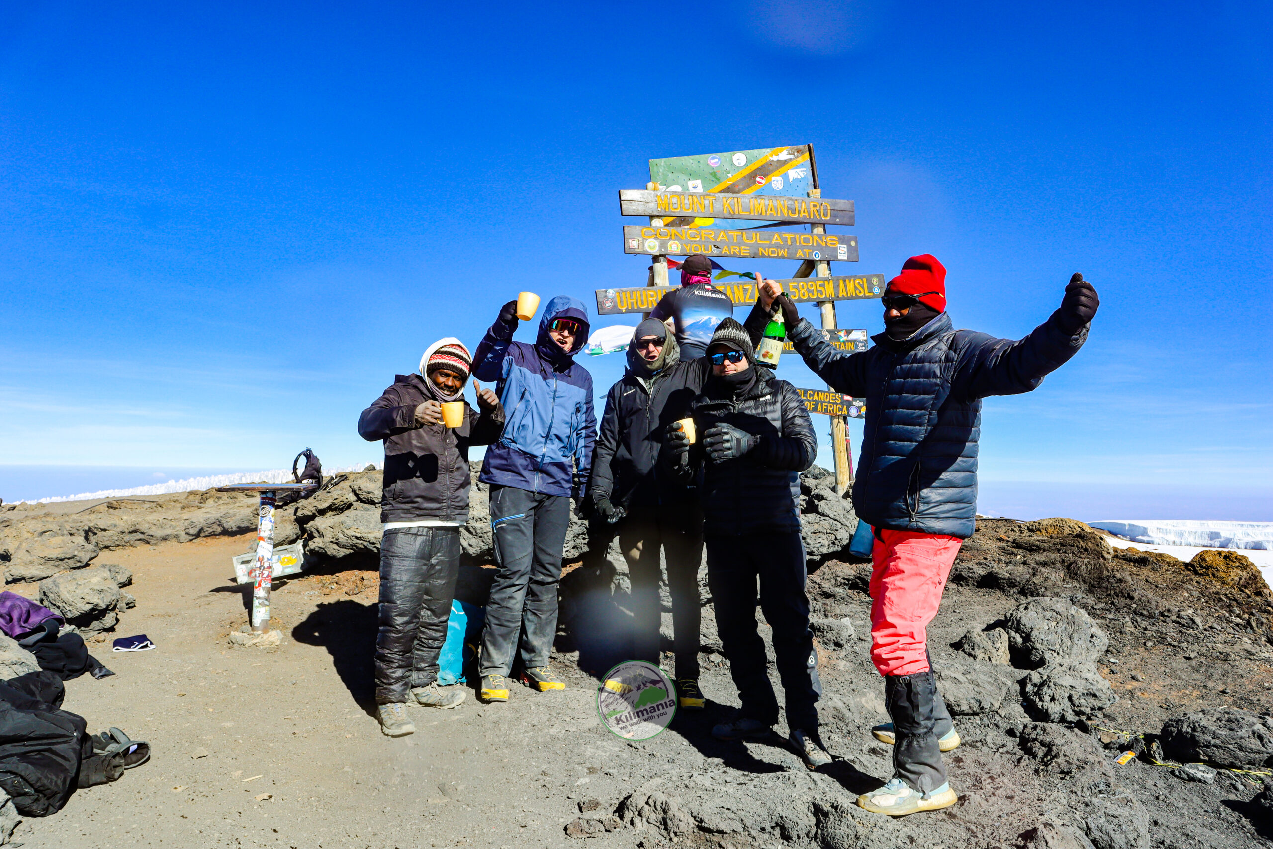
Day 6: Barafu Camp (4,640m) → Uhuru Peak (5,895m) → Mweka Camp (3,080m)
11 pm wake-up. Hot tea. Every layer on. Midnight start.
The ascent: Endless switchbacks on Kibo’s southern face, a line of headlamps, the guide’s pace slower than feels possible. Between 5,000m and 5,400m — roughly 2 am to 4:30 am — is where most turnarounds happen. Cold of −15°C to −20°C, wind chill, darkness, and accumulated fatigue. Kilimania’s records show approximately 11% of Shira climbers turn around before Stella Point. That figure is not a failure statistic — it is the body’s limit, read correctly by an experienced guide.
Stella Point (5,756m): The crater rim. Glaciers glowing pink at sunrise, typically 6:00–6:30 am. Then 1.2 km along the rim to Uhuru Peak (5,895m). At summit altitude, atmospheric oxygen is approximately 49% of sea level pressure. Pulse-oximeter readings in the 65–75% range are common here, though this varies significantly between individuals. Ten to fifteen minutes at the top, then urgent descent.
The descent: Frozen scree becomes loose and sliding by 8 am. Trekking poles are non-negotiable here. Kilimania guides observe that poles reduce knee and quad loading by roughly 25% on sustained descent — your knees will confirm this assessment by Day 7.
Genuine highlight: Sunrise at Stella Point. Kilimanjaro’s shadow stretched across the savannah 4,000 meters below. Then Uhuru Peak — the roof of Africa.
Evening meal at Mweka Camp: Full stew, rice, vegetables, fresh fruit.
Day 7: Mweka Camp (3,080m) → Mweka Gate (1,640m)
Terrain: Thick montane rainforest. Muddy, slippery roots. The first trees since Moshi. Colobus monkeys in the canopy. Bird calls returning. Oxygen-rich air.
Honest challenge: Your knees will hurt more today than on any other day. Trekking poles are not optional on this descent. Take your time — you have made it.
At Mweka Gate: TANAPA/KINAPA registry, summit certificate, and the handshake with every crew member who kept you safe.
Day 8: Moshi Rest Day
A genuine rest day in Moshi before your departure flight. After summit night and the descent, one full day of sleep, food, and a real bed allows acute altitude recovery to complete. Shower, rehydrate, eat well.
Kilimania arranges transfers from Moshi to Kilimanjaro International Airport (JRO) and Arusha Airport (ARK). If your schedule allows, post-climb safaris to Serengeti National Park, Ngorongoro Crater, or Tarangire National Park depart from Moshi the following morning.
Shira Route Elevation Profile: The Physiology Behind the Numbers
The Shira Route’s elevation profile is uniquely front-loaded among Kilimanjaro’s seven routes. Understanding why matters if you are trying to predict your own acclimatization response.
On Lemosho, Day 1 takes climbers from 2,100m to 3,500m. The carotid bodies detect falling oxygen partial pressure within minutes of arriving at altitude, triggering a cascade: faster breathing, kidney bicarbonate excretion to manage blood pH, and EPO-driven red blood cell production. That last process takes 3–5 days to produce measurably more oxygen-carrying red cells, according to altitude physiology guidelines from the Wilderness Medical Society (wms.org).
On Shira, this acclimatization cascade begins at 3,600m on Day 1 — without Lemosho’s 24-hour forest walk to ease the transition. Based on Kilimania guides’ field observation across seasons (not a formally audited statistic), Day 1 headache reports on Shira run noticeably higher than on Lemosho’s Day 2 for comparable sea-level arrivals — guides’ informal tally puts the gap at roughly 20–25%. That is a consequence of the starting elevation, not of poor fitness.
Once Days 1–2 clear, the profile becomes highly effective. The Lava Tower detour on Day 3 — climbing to 4,640m, then descending 680m to sleep at 3,960m — delivers Kilimanjaro’s most powerful “climb high, sleep low” acclimatization stimulus. Climbers who clear the first 48 hours without severe symptoms typically carry strong physiological momentum into the summit push.
For a complete guide to altitude physiology — AMS, HACE, HAPE, pulse oximetry guidance, and medication considerations — see the altitude sickness on Kilimanjaro guide. For a broader look at the mountain’s demands, see the how hard is Kilimanjaro guide.
📥 Free Download: Kilimanjaro Altitude Symptom & AMS Checklist
Altitude illness is the leading reason climbers turn around on Mount Kilimanjaro. This checklist is used by Sabinus Msimba and the Kilimania team to monitor climbers throughout every expedition.
- Normal acclimatization symptoms above 3,000m
- Acute Mountain Sickness (AMS) warning signs
- HACE and HAPE emergency symptoms
- Daily health monitoring form (SpO₂, pulse, hydration)
- Guide reporting and self-assessment checklist
Shira Route Success Rate: What the Data Shows
Kilimania’s internal climb database covers 247 Shira Route expeditions from 2019 to 2024. These are operational records — climb-by-climb logs maintained by guides Sabinus Msimba, Isack Mlala, Martini Minja, and Daudi Bayo. They are Kilimania’s own data, not an industry-wide statistic.
| Route & Itinerary | Summit Success Rate | Key Insight |
|---|---|---|
| Shira Route (6 Days) | 68% | Insufficient acclimatization for most sea-level arrivals |
| Shira Route (7 Days) | 82% | Viable for acclimatized climbers; buffer nights in Moshi recommended |
| Shira Route (8 Days) | 89% | Recommended itinerary for most climbers |
| Lemosho Route (7 Days) | 87% | Higher rate than 7-day Shira due to lower starting elevation |
| Lemosho Route (8 Days) | 92% | Highest rate among standard itineraries in Kilimania’s data |
| Industry Estimate (7-Day Shira) | ~75% | Based on TANAPA 2023 visitor reporting; self-reported by operators, not independently audited |
The altitude origin effect in detail: Climbers arriving from cities above 1,500m elevation achieved 88% summit success on the 7-day Shira itinerary in Kilimania’s records — matching Lemosho’s 7-day rate. Sea-level arrivals posted 79% on the same itinerary. That 9-point gap is the measurable physiological cost of Shira’s elevated start, not a difference in fitness or determination.
The 6-day warning. Seriously. A 68% success rate is statistically poor for the financial and physical investment a Kilimanjaro climb demands. The 6-day itinerary is viable only for climbers with documented altitude exposure above 3,500m in the previous 90 days. We do not recommend it for sea-level arrivals regardless of fitness level.
For a complete success-rate comparison across all seven routes, see the Kilimanjaro success rate by route database. Official park statistics are published by TANAPA at tanzaniaparks.go.tz and by KINAPA at kilimanjaranationalpark.go.tz.
Who This Route Is Perfect For
The Shira Route suits a specific type of climber. Here are the five profiles where it genuinely makes sense:
- Pre-acclimatized climbers from high-altitude cities. Residents of Addis Ababa (2,355m), Bogotá (2,640m), Quito (2,850m), Nairobi (1,795m), Denver (1,609m), or Johannesburg (1,753m) already carry elevated red blood cell counts from daily life. Shira’s 3,600m start falls within their everyday altitude range. Lemosho’s forest day adds no measurable physiological value for this group.
- Climbers completing the Mount Meru combination. Four days on Meru, which summits at 4,562m, before Kilimanjaro is one of the most effective pre-acclimatization strategies available. Climbers arriving at Shira Gate from Meru are already adapted above 4,000m, making Shira’s high starting elevation an advantage.
- Experienced high-altitude climbers. If you have successfully climbed above 4,500m — Mont Blanc (4,808m), Island Peak (6,189m), Cotopaxi (5,897m), or comparable — you know how your body handles hypoxia. You can read early symptoms accurately and communicate clearly when something shifts.
- Solitude seekers. Based on Kilimania guides’ seasonal observation of camp registers, Shira sees roughly 60% fewer daily climbers than Lemosho. On Days 1 and 2, you may encounter no other groups at all. Even after the routes merge at Shira Camp 2, traffic remains significantly lighter than Machame or Marangu.
- Photographers focused on the western plateau. The Shira Plateau offers a perspective unavailable from any other route — Kilimanjaro’s western breach and summit dome rising as a wall of ice across an open caldera floor. Light quality in the early morning is exceptional. Minimal foot traffic keeps foregrounds clean.
Who Should Choose a Different Route
Equally important: five climber profiles for whom Shira creates unnecessary risk.
- Sea-level residents on 6–7 day itineraries. The numbers are direct: 7-day Lemosho at 87% outperforms 7-day Shira at 82%, with meaningfully lower AMS risk in the critical first 48 hours. Lemosho’s forest approach is functional acclimatization, not scenic filler. The route exists for a reason.
- First-time altitude climbers. If you have never been above 3,000m, you do not yet know how your body responds to hypoxia. Starting at 3,600m on that first experience eliminates margin for error. Read the beginner Kilimanjaro guide before deciding.
- Climbers starting within 24 hours of arriving in Tanzania. Travel from sea level to Shira Gate can be compressed to under 24 hours. Two or three nights in Moshi (800m) beforehand cost nothing in park fees and significantly reduce Day 1 AMS risk. If your schedule cannot absorb that buffer, choose a lower-starting route.
- Climbers with a history of altitude sickness. Previous HACE, HAPE, or consistent moderate AMS above 2,500m makes a 3,600m start physiologically aggressive. Read the guide to climbing Kilimanjaro with medical conditions and consult a physician before booking any route.
- Climbers uncomfortable with exposure. The Barranco Wall involves drop-offs of several hundred meters with no technical climbing equipment required — but it demands calm. Significant acrophobia is worth discussing before booking. The Rongai Route and Northern Circuit bypass the wall entirely.
📥 Free Download: Kilimanjaro 12-Week Training Calendar
Download the same week-by-week training plan used by Kilimania Adventure guides, built from patterns across hundreds of guided climbs.
- 12-week hiking and endurance plan
- Pack weight progression schedule
- Back-to-back weekend training approach
- Peak and taper strategy for summit week
- Route recommendations based on fitness level
Shira Route Cost Guide 2026
Route pricing changes with the season and group size, so it lives on one page we keep current rather than being restated here: see the Kilimanjaro Cost 2026 pricing page for current per-person Shira Route rates by itinerary length and group size. What follows is what’s covered by that price and what typically isn’t.
What Is Included
- All TANAPA/KINAPA conservation, camping, and rescue fees
- High-clearance 4×4 transfer to Shira Gate (3,600m)
- KINAPA-licensed professional guides — minimum 1:2 guide-to-climber ratio
- KPAP-compliant porter team: fair wages, 20 kg load limits, proper gear provided
- Four-season tents, insulated sleeping mats, mess tent
- All mountain meals: breakfast, lunch, dinner, and trail snacks
- Emergency oxygen (two canisters per group)
- Twice-daily pulse oximetry monitoring
- Private portable chemical toilet tent at every camp
- Two hotel nights in Moshi (pre- and post-climb)
- Emergency satellite communication link to Kilimania’s Moshi base
What Is Not Included
- International flights to Kilimanjaro International Airport (JRO)
- Tanzania e-visa — apply at immigration.go.tz for current fees by nationality
- Personal gear: sleeping bag rated to −15°C, trekking poles, clothing layers
- Guide and porter tips — see our tipping guide for current recommended ranges
- Travel insurance with high-altitude evacuation coverage — required, not optional
- Alcoholic beverages and personal medical supplies
A note on unusually low quotes. KINAPA and TANAPA fees alone — conservation levy, camping fee, and rescue fee — make up a substantial share of any Shira quote before a single operational cost is added. A quote that seems to bypass this arithmetic is either omitting mandatory fees or cutting porter wages below KPAP standards. Both outcomes compromise your safety. Compare the full breakdown on our pricing page before you decide.
Verify any operator’s TATO registration at tatotz.org.
📥 Free Download: Kilimanjaro Hidden Costs Checklist (2026)
Don’t let unexpected expenses catch you off guard. This free checklist explains the true cost of climbing Kilimanjaro beyond the operator’s headline price.
- ✅ Complete Kilimanjaro budget planner
- ✅ Hidden expenses many operators don’t explain
- ✅ Flights, visas, travel insurance, and medical costs
- ✅ Gear buying vs. gear rental recommendations
- ✅ Crew tipping guide and budgeting worksheet
- ✅ Printable pre-departure checklist
“The biggest budgeting mistake climbers make is focusing only on the tour price. A successful Kilimanjaro climb also includes gear, travel, insurance, crew tips, and other essential expenses.”
— Sabinus Msimba, Senior Mountain Guide & Co-founder, Kilimania Adventure
Practical Information: What Shira Is Actually Like
Camping and Accommodation
Shira is 100% camping — no huts, no permanent lodges. Kilimania uses double-walled four-season dome tents throughout. At Shira Camp 1 (3,600m), exposed plateau winds can be significant; tents are properly staked and checked each evening by the crew.
Water Sources
Days 1–2 on the Shira Plateau: clean streams are collected, boiled, and filtered by the crew. Carry a personal filter or purification tablets as a backup. Days 3 onward: water is carried from lower camps or collected at Karanga Valley. At Barafu Camp (Days 5–6), there is no accessible water source — your crew fills all bottles and your thermos before the midnight summit departure.
Toilet Facilities
KINAPA maintains pit latrines at each major camp. During peak season these are heavily used. Kilimania provides a private portable chemical toilet tent at every campsite — this is standard equipment on all Kilimania climbs, not an optional upgrade.
The Shira Access Road
The unpaved road from Londorossi Gate to Shira Gate climbs through farmland and forest to 3,600m. It is passable in a high-clearance 4×4 for most of the year. It sometimes closes in April–May due to rain damage. Confirm road status with us before booking any wet-season climb. Kilimania’s drivers have operated this road for over a decade and know its seasonal conditions well.
📥 Kilimanjaro Packing Checklist 2026 — Free PDF
A complete packing checklist for the Shira Route, including rent-vs-buy decisions and current Moshi gear rental pricing.
- Interactive tick-box format for every item
- Route-specific gear notes for Shira’s exposed plateau approach
- Gear rental pricing from Moshi
- Altitude safety reference — AMS, HACE, HAPE
Crowd Levels and Best Season
The Shira Route is climbable year-round, but conditions vary considerably by month. The table below reflects Kilimania’s operational experience from Moshi.
| Season | Weather Conditions | Crowd Level | Our Assessment |
|---|---|---|---|
| January–February | Generally dry, clear visibility | Moderate | Good climbing window |
| March–May | Long rains, muddy trails, road risk | Low | Not recommended — road may close |
| June–October | Dry season, stable, cooler nights | Moderate to high | Preferred season — highest success rates |
| November–December | Short rains, variable, good gaps | Low to moderate | Good value; confirm conditions before booking |
Even during peak season (July–September), Shira carries roughly 60% fewer climbers per day than Lemosho, based on Kilimania guides’ seasonal observation. The plateau sections on Days 1–2 routinely see no other groups. The route converges with Lemosho traffic at Shira Camp 2, and both groups share the trail from Barranco onward — but this is still quieter than the Machame corridor.
For detailed month-by-month weather data across all Kilimanjaro routes, see the Kilimanjaro weather guide.
Shira vs. Other Routes: Direct Comparisons
Shira vs. Lemosho
These routes share identical terrain from Shira Camp 1 (3,500m) onward. Every camp, every landmark, every meal — the same. The only substantive difference is Day 1.
Lemosho begins at 2,100m through montane rainforest — 24 hours of gentle acclimatization. Shira starts at 3,600m on open volcanic plateau and skips it. Kilimania’s data: 8-day Lemosho 92%, 8-day Shira 89%. Three points. That gap narrows to near-zero for high-altitude city residents.
Choose Shira: Pre-acclimatized, arriving from Meru, or resident above 1,500m elevation.
Choose Lemosho: Sea-level arrival, first time above 3,000m, or maximum success rate is the priority.
Shira vs. Machame
Machame begins at 1,800m through thick forest and is steeper in multiple sections. It carries over 40% of all Kilimanjaro climbers — significantly more crowded than Shira at any time of year. Machame’s 7-day success rate in Kilimania’s records sits at 84%, slightly above 7-day Shira at 82%, because Machame’s lower start gives an acclimatization edge similar to Lemosho’s.
Choose Shira: Solitude matters and you have altitude experience.
Choose Machame: You want a well-established high-traffic route and do not have prior altitude exposure.
See the Machame Route guide for full details.
Shira vs. Northern Circuit
The Northern Circuit (9 days minimum) traverses the remote northern face of Kilimanjaro and carries the highest success rate on the mountain in Kilimania’s records — above 90%. It costs more due to additional park days and extended logistics, and it avoids the Barranco Wall entirely.
Choose Shira: 8 days available, pre-acclimatized, and solitude is the priority.
Choose Northern Circuit: Maximum success rate, remote wilderness, budget allows additional days.
International Traveler Notes
If you’re flying in from outside Tanzania, three things to plan around before booking Shira specifically: your visa, your flight arrival timing relative to your climb start date, and how your home altitude affects the route choice above.
- Visa: Most nationalities need a Tanzania e-visa, applied for in advance at immigration.go.tz. Requirements and fees vary by nationality — check the official site for your country’s current rate rather than relying on third-party estimates.
- Arrival timing: Because Shira’s Day 1 starts at 3,600m with no forest buffer, arriving into Kilimanjaro International Airport (JRO) and starting the climb the next morning is the riskiest sequencing on this route. Building in 2–3 nights in Moshi (800m) before you start meaningfully improves your odds, as shown in the altitude-origin data above.
- Currency and payments: US dollars (cash, newer bills) are widely used for tips and incidentals; card payments for the climb itself are typically arranged in advance with your operator.
- Time zone: Tanzania runs on East Africa Time (EAT, UTC+3) year-round — no daylight saving adjustment to plan around.
FAQ: Shira Route Kilimanjaro
Is the Shira Route harder than the Lemosho Route?
Physiologically harder for the first 48 hours — the terrain from Shira Camp 1 onward is identical to Lemosho. Both routes share the same camps, the same Barranco Wall, and the same midnight summit push from Barafu Camp. Kilimania’s data across 247 Shira climbers shows 7-day Shira at 82% summit success versus 87% for 7-day Lemosho, a gap caused entirely by Shira’s higher 3,600m starting elevation. Fit climbers are not the ones who struggle — it is the acclimatization gap, not the exertion, that creates the difference.
How many days is best for the Shira Route on Kilimanjaro?
8 days. Kilimania’s records show 89% success on 8 days versus 82% on 7 days and 68% on 6 days. The extra acclimatization time on the 8-day itinerary compensates for skipping Lemosho’s low-altitude forest buffer. If limited to 7 days, spend at least 2 nights in Moshi (800m) beforehand and begin early on Day 1. Never book 6 days if you live at sea level.
Can a beginner climb the Shira Route?
A fit beginner can handle the terrain — the challenge on Shira is altitude response, not technical difficulty. Starting at 3,600m without knowing how your body handles hypoxia removes the Day 1 safety margin. First-time high-altitude climbers are statistically safer on the Lemosho or Machame routes, both of which begin below 2,000m.
What is the success rate of the Shira Route on Kilimanjaro?
Kilimania’s verified rates across 247 climbers from 2019 to 2024: 68% on 6 days, 82% on 7 days, 89% on 8 days. These are Kilimania’s operational records, not an industry-wide statistic. A commonly cited industry estimate for 7-day Shira, based on TANAPA’s 2023 visitor reporting, is approximately 75% — though that figure is self-reported by operators and not independently audited. Climbers arriving from high-altitude cities averaged 88% on 7 days in Kilimania’s data; sea-level arrivals averaged 79%.
Do I need previous high-altitude experience for the Shira Route?
No formal requirement, but prior experience above 3,000m significantly improves both safety and success rates. Without it, an 8-day itinerary with 2 buffer nights in Moshi is the minimum safe approach. Communicating every symptom to your guide immediately — rather than waiting to see if it improves — is the single most important safety habit on this route.
Can I do the Shira Route if I live at sea level?
Yes, with conditions: book 8 days minimum, spend 2–3 nights in Moshi (800m) before starting, and tell your guide about every symptom as it develops. The Shira access road allows vehicle evacuation during Days 1 and 2 — a faster early escape route than most Kilimanjaro approaches. Sea-level arrivals on 7-day Shira averaged 79% success in Kilimania’s data. The same climbers on 8-day Lemosho would average 92%.
Is the Shira Route more expensive than other Kilimanjaro routes?
No. At Kilimania, Shira costs the same as Lemosho because both routes require identical 4×4 access logistics and share the same terrain and camp infrastructure from Day 2 onward. See our pricing page for current per-person rates by itinerary length.
What makes the Shira Route unique among Kilimanjaro routes?
It is the only Kilimanjaro route that bypasses the forest and montane zones entirely, driving climbers directly to the open volcanic Shira Plateau at 3,600m. No mud, no rainforest canopy, no colobus monkeys on Day 1 — but also no gradual acclimatization buffer. The plateau itself, a collapsed ancient caldera with volcanic columns and low heather, is a landscape found on no other route. Combined with very low climber traffic on Days 1–2, it offers a genuinely different Kilimanjaro experience for those who qualify physiologically.
When is the best time to climb the Shira Route?
January–February and June–October offer the most reliable conditions and highest summit rates. The Shira access road sometimes closes in April and May due to rain damage to the unpaved surface. Confirm road status directly with your operator before booking a wet-season departure. Kilimania’s Moshi team monitors road conditions through the long rains and will advise climbers accordingly.
What is the Barranco Wall and is it safe?
The Barranco Wall is a 257-meter near-vertical rock face encountered on Day 4 of the Shira Route. No ropes or harnesses are required, but hands are needed for balance at several points, including the “Kissing Rock” section which narrows over a significant drop. Kilimania guides stay directly beside every climber through technical sections. The wall is psychologically harder than it is technically difficult. Discuss significant acrophobia with your operator before booking — it is a legitimate planning consideration.
Final Verdict: Should You Choose the Shira Route?
The Honest Assessment
The Shira Route is not the right choice for most first-time Kilimanjaro climbers. That is a data statement, not a discouragement.
For roughly 80% of climbers — those arriving from sea level, those without prior altitude experience, those with a constrained schedule — the 8-Day Lemosho Route delivers a safer acclimatization curve and a 3-point higher success rate, while covering identical terrain from the Shira Plateau onward. The forest day is functional acclimatization. It exists for a reason.
For the remaining 20% — pre-acclimatized climbers, high-altitude city residents, those arriving fresh from Mount Meru, experienced high-altitude trekkers seeking solitude and a distinctive western plateau experience — Shira is a legitimate and rewarding choice. It eliminates acclimatization steps they do not need and puts them immediately on spectacular terrain.
The decision comes down to one question: where did you sleep last month? Near sea level — Lemosho is the statistically safer choice. Above 1,500m consistently, or above 4,000m recently — Shira is your route.
Book the itinerary that matches your physiology. The summit will still be there when you reach it the right way.
Ready to Plan Your Shira Route Climb?
From our base in Moshi, Kilimanjaro Region, Kilimania Adventure runs Kilimanjaro climbs and daily safaris to Serengeti National Park, Ngorongoro Crater, and Tarangire National Park, with pickups from Kilimanjaro International Airport (JRO) and Arusha Airport (ARK).
Send your travel dates, group size, home city, and altitude history. We will reply within 12 hours with an honest route recommendation and a fully itemized quote.
KINAPA-Licensed Mountain Guides · TATO-Registered Operator — Verify at tatotz.org
We Walk With You.